
Afternoon spring thunderstorms are likely over the next few days, especially on Thursday when we could see some severe here in the Carolinas as a strong cold front pushes through. This front will cause temperatures to drop drastically, as many of us will be in the 80s on Wednesday, and even some in South Carolina in the upper 80s.
Severe storms are possible on Thursday as this front slices through warm air. Also, rain is a concern as it is expected to be heavy in spots, and could cause flash flooding. By Friday, the cold front will be well offshore and we will have much cooler and breezy conditions. It will basically be a big blast of fresh air.
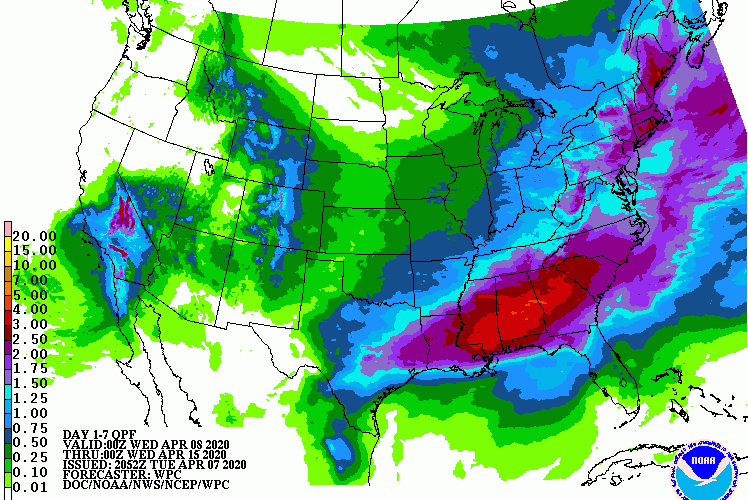
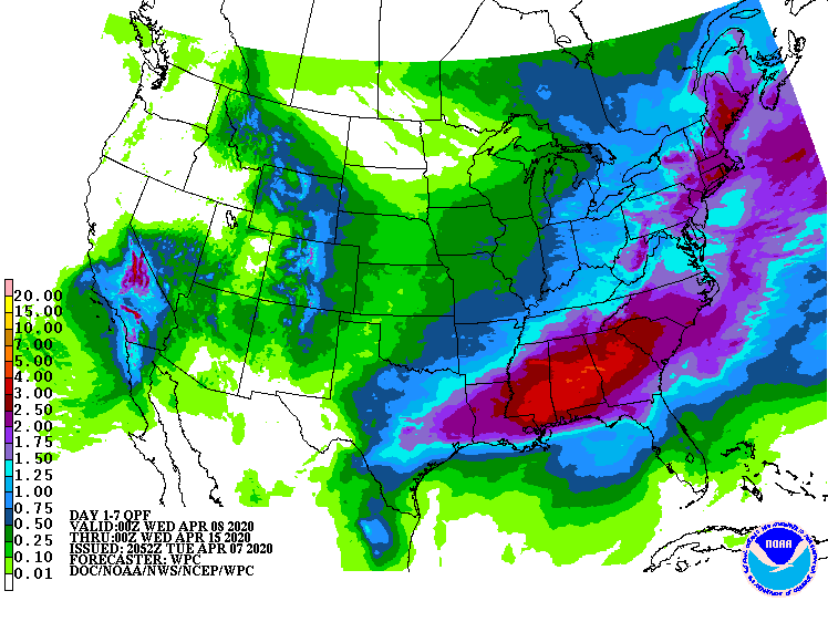
The precipitation graphic below is from the WPC, and shows total rain amounts into Tuesday 8 pm of next week. This will be welcome rain as fire conditions are becoming elevated. Rain is also perfect weather for staying at home. Some of the rain that comes on Sunday, however, could come in the form of a severe outbreak that many weather outlets are currently monitoring and talking about. It’s still too early to discern any details, but we will bring you the latest if this situation develops.
Stay alert tomorrow and Thursday, as any day can bring severe storms. Have a source for NWS warnings!
-CWA
You must be logged in to post a comment.