
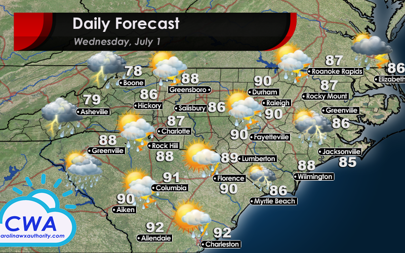
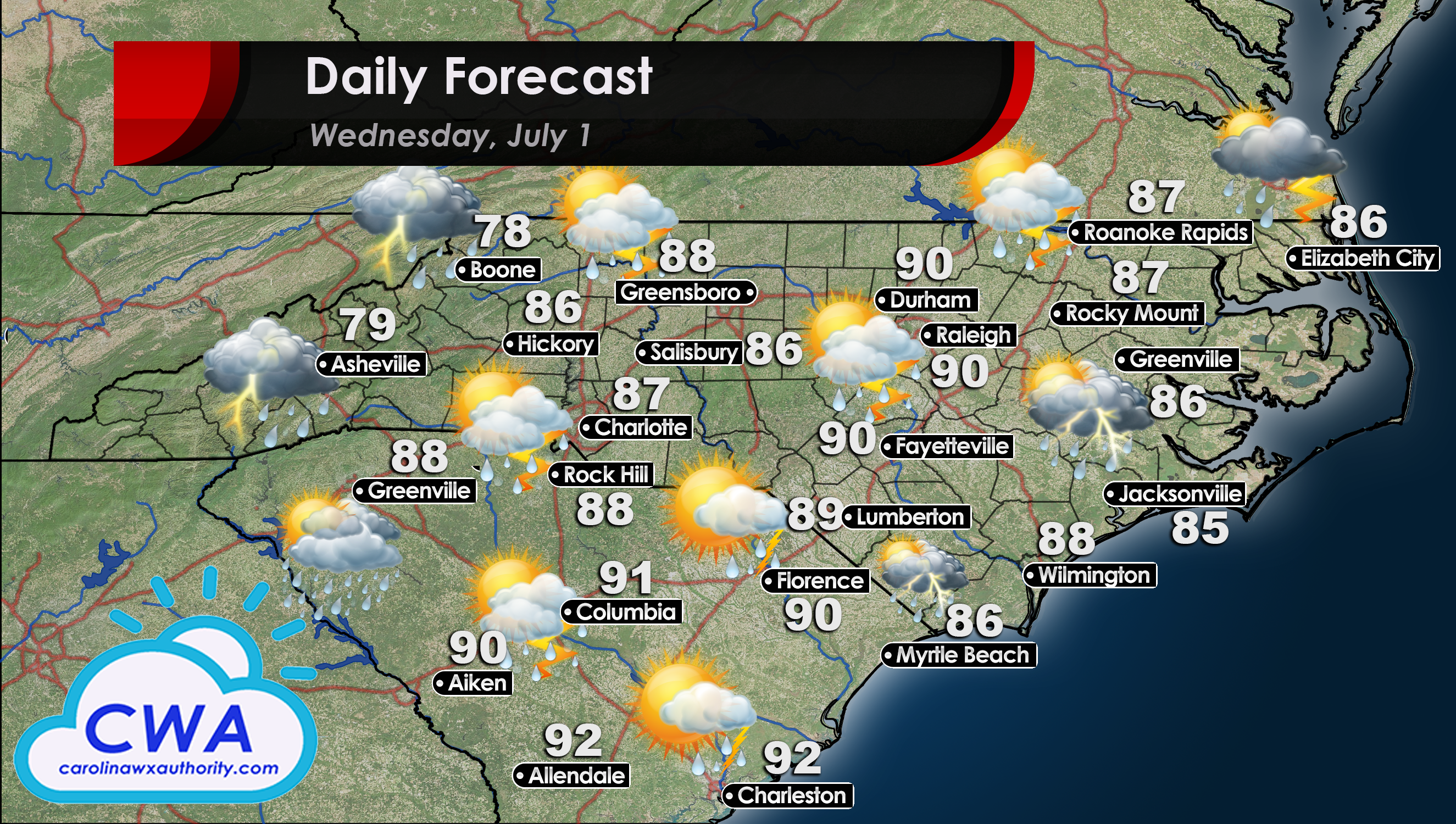
Slightly Cooler Temps in the Daily Forecast for Wednesday
Wow, that was a crazy day yesterday! The Carolinas saw strong and rapid storm development Tuesday afternoon. The good news is that the Daily Forecast for Wednesday will be slightly cooler and slightly less humid than Tuesday. The actual air temperatures should stay in the upper 80s to 90°F for Central and Eastern North Carolina as well as Northern South Carolina. Temps will be a bit more elevated in Columbia SC and locations to the south, topping out in the low to mid 90s. However, urban areas and locations with a lot of concrete/asphalt will trend a few degrees higher than more outlying areas.
Storms will be Less Widespread for Most
Models continue to suggest that the majority of the Carolinas will be experiencing less thunderstorm activity on Wednesday. The exception to this is at coastal communities. Locations along the coast, especially from Myrtle Beach and locations to the north, will have the best chance for thunderstorm development at 30% to 40%. This is largely due to a surface trough pushing into the region early to mid afternoon.
There is also a good chance for precipitation in Boone, Asheville, and locations to the west on the windward side of the Blue Ridge Mountains. However, with mostly cloudy conditions, these events should be mostly rain with much less chance of thunderstorm formation.
Before you Go…
You have undoubtedly heard the term cut-off low or upper level low here, and elsewhere, over the last few months. These pieces of upper-atmosphere energy are notoriously difficult to forecast as they tend to form in areas with little to no outside steering. Hopefully you have read Joshua’s article about how the Holiday Weekend Forecast Remains Unsettled. There is some evidence to suggest another cut-off low will move into our area late this week. We will be working hard to make sure you are informed and ready for anything that comes our way.
Speaking of working hard, you can reward our hard work by making sure you have liked and followed our Facebook Page! We have been tirelessly enhancing the quality of our reporting and the frequency of posts there. We might also have some exciting news to share in the next week or two regarding the page. Don’t miss out!
You must be logged in to post a comment.