
Outlook Matrix:
Unsettled pattern to continue through the end of March. After a brief warmup this weekend we will dip back down below average next week with wintry weather looking to make it into the region Tuesday (3/20).
I can not show you the NAO forecast, but it is forecasted to move into the positive phase which usually corresponds with higher heights and above average temperatures when we begin April
| Dates | Threats | Significance | Confidence (1-5) |
| 3/18 – 3/21 | Temperatures | Above average for the weekend and the beginning of next week | 5 |
| 3/18-3/19 | Heavy Rain | Above average precipitation for the Tennessee and Mississippi Valley | 4 |
| 3/21 | Winter Storm | Winter storm looks to take aim at the Mid-Atlantic and Carolinas | 4 |
| 3/21-3/23 | Temperatures | Below average temperatures will continue to overtake the area | 3 |
| 3/13/3-23 | Precipitation | Slightly below average precipitation over this span | 3 |
| End of March | Temperatures | Temperatures look to be below average to end the month | 4 |
| Beginning of April | Temperatures | We look to return back to average in the beginning of the mont | 3 |
| Middle of April | Temperatures | Finally, above average temperature make their way into the East and spring finally arrives | 3 |
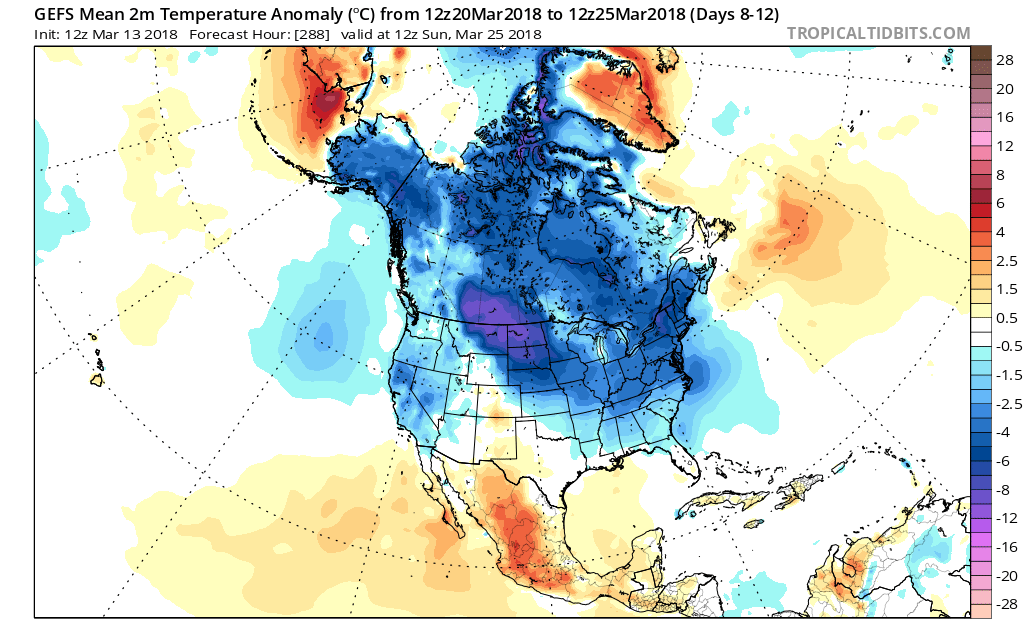
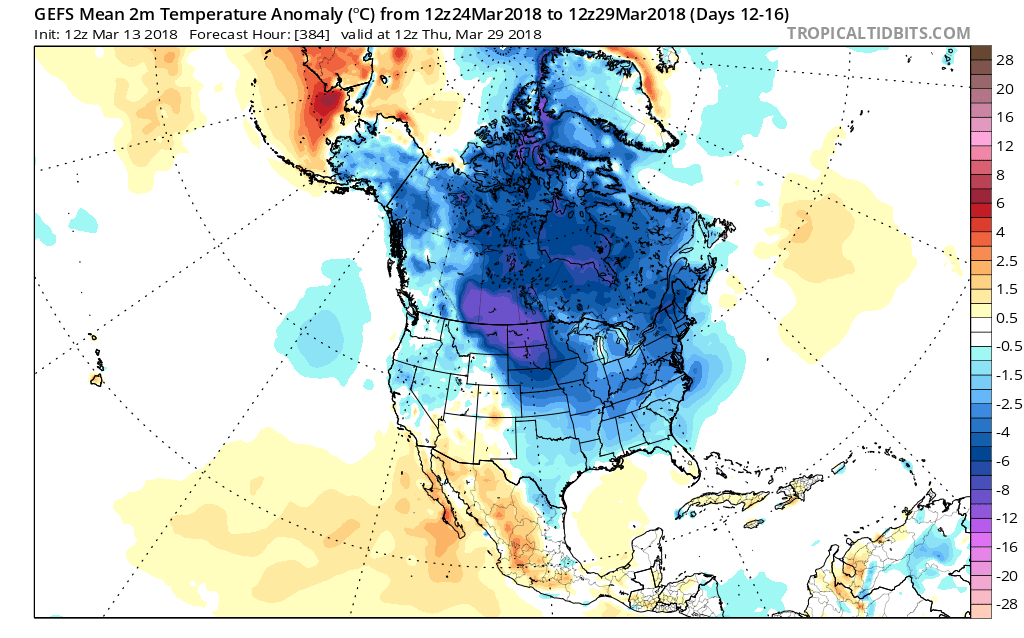
GEFS ensembles look to sustain below average temperatures through the end of the month of March.
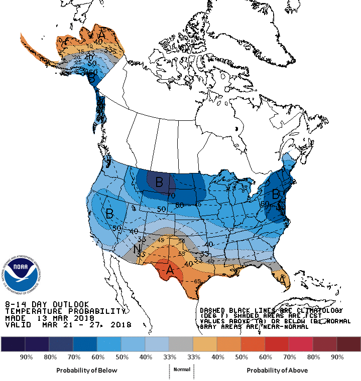
NOAA CPC 8-14 Day Outlook:
Ongoing updates and emails are sent out to premium subscribers well in advance of a significant weather event. Business owners are updated more frequently and are followed during the storm with personalized, hyper-local updates both by email or phone. Become a member using the link above to join the action.
Forecaster: Bielfeld
Last Updated: 3/13/2018
Climate forecast data gathered from the CPC: http://origin.cpc.ncep.noaa.gov/products/people/mchen/CFSv2FCST/weekly/