
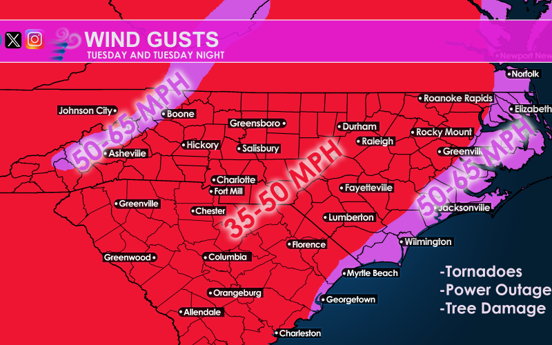
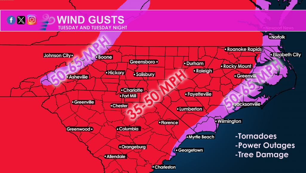
There is a high likelihood of severe weather Tuesday across the region. Power outages are possible so be sure to charge those electronic devices. However, things could get serious since tornadoes are also expected, and could be for anyone.
Per Jesse StormTracker Sacher from a post earlier:
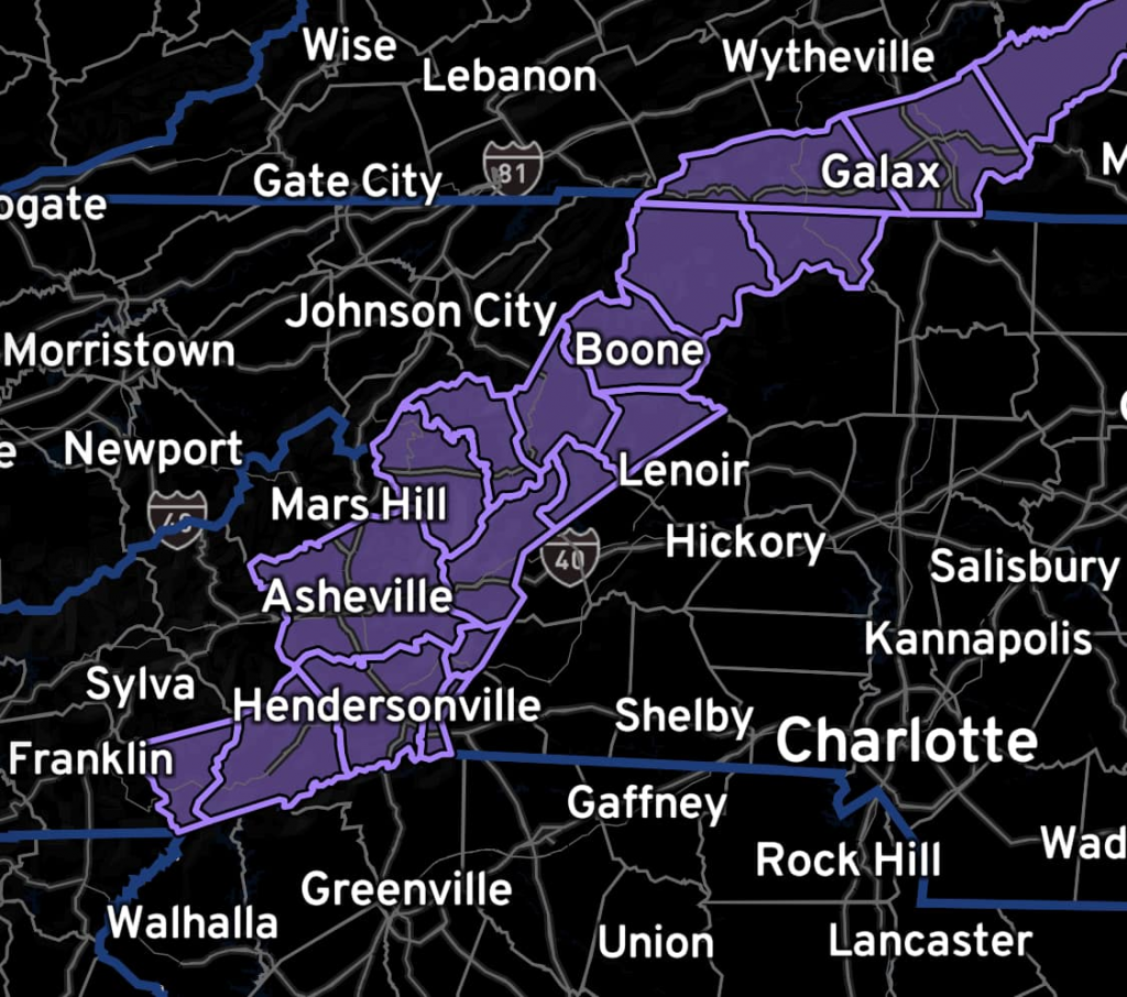
SEVERE THREAT INCREASING: Severe weather outbreak is LIKELY for the central and eastern Carolinas on Tuesday into Tuesday night. Just as we speculated, the Storm Prediction Center has raised the risk of severe weather to “enhanced” or 3/5 over the large area in orange and has introduced a yellow hatched area where they feel tornadoes are more likely with the possibility of “strong” (EF2 or higher) tornadoes in that zone. Keep in mind that tornadoes are also still possible in the brown and green zones AND damaging wind gusts are possible everywhere. Winter Weather Advisories are also issued for western North Carolina believe it or not in anticipation of freezing rain at the onset of precipitation. Be prepared for schedule changes and possible alterations to your plans on Tuesday. Stay with us and have a way to receive emergency alerts. Take them seriously.
Also for Monday Night (tonight):
Winter Weather Advisories in place for overnight tonight into early Tuesday with the anticipation of light to moderate freezing rain at the onset of precipitation in this areas:
Prepare for power outages and have a plan of action should a tornado warning be issued.
You must be logged in to post a comment.