
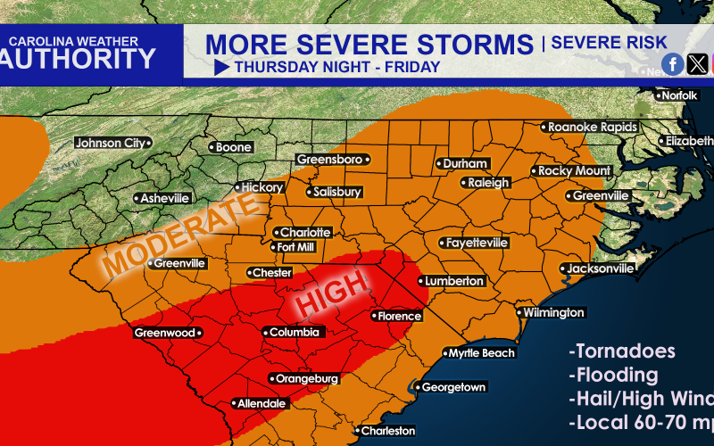
Charge those phones and prepare for more power outages! This is not welcome news due to the recent “land hurricane,” but more unstable weather will head our way Thursday. This storm won’t be as powerful (I’ve never seen anything like we just had since I lived here in 2014), but it still could pack a punch.
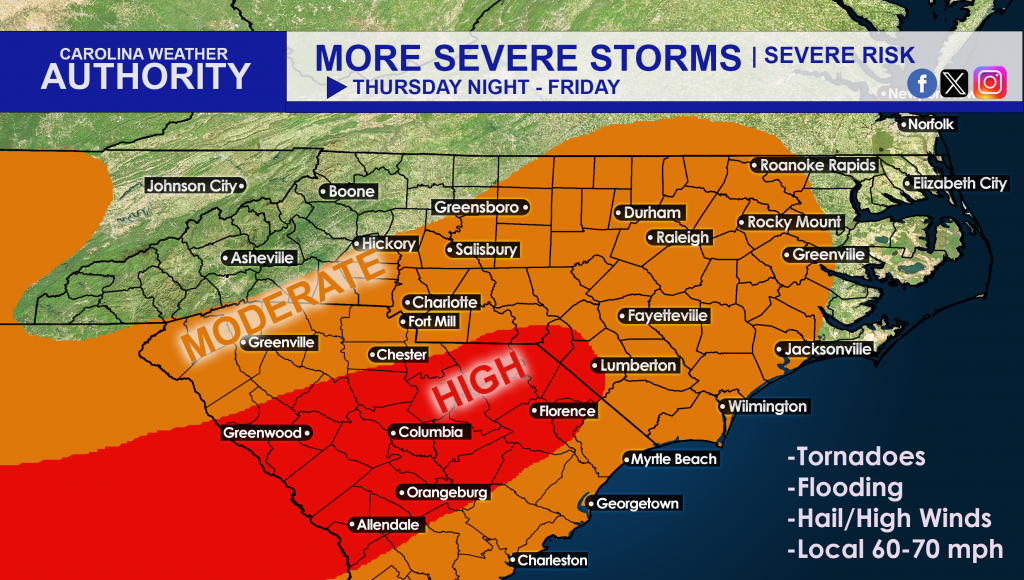
Tornadoes are possible in the orange, but are more likely in the red. Gusty winds ahead of the approaching storm system will also cause issues with loose outdoor items and even travel. Basically it will be a redux version of the storm we just had. And the pattern doesn’t look to let up anytime soon.
Timing: Between 7pm Thursday and midnight.
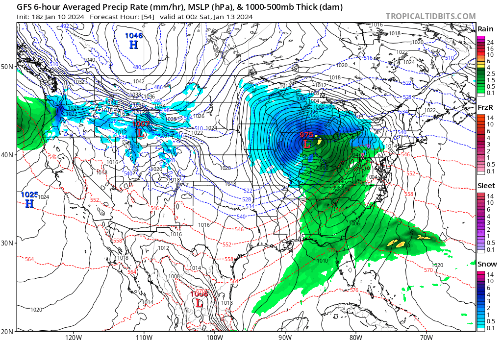
Below is the GFS for Friday, and this is another huge system that will cover a lot of real estate:
Behind this exiting storm system, you guessed it, more wind and cold, especially on Saturday. The mountains could see some flakes along with cold and blustery conditions.
Then next week we have our big Arctic plunge. This will wreak havoc on power grids throughout the nation’s heartland.
You must be logged in to post a comment.