
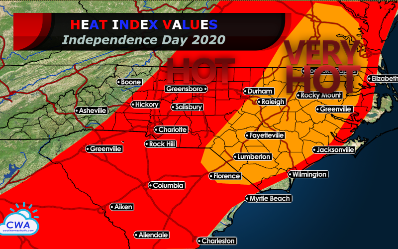
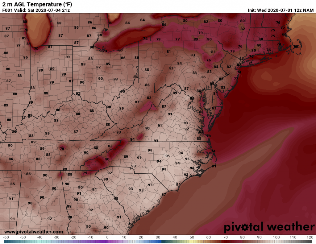
A few days ago, it appeared a trough of low pressure would bring cloudier and cooler weather to the Carolinas this weekend. Recent model trends have delayed that cooler weather until early next week, and the hottest temperatures so far this season are expected on Saturday, July Fourth. High temperatures appear headed into the middle 90s for much of the central and eastern Carolinas away from the coast. Beach locations will top out in the 80s, except for the northern Outer Banks which may stay in the upper 70s.
With dewpoint values in the lower 70s east of I-85, heat indices will climb into the upper 90s for areas of west of U.S. 1, and up to 100-105 degrees along and east of U.S. 1. The heat index in Raleigh may climb to 102, and in Greenville, Fayetteville, and Florence it may climb to 105. Chances for rain are low across much of the area for most of the daylight hours. A backdoor cold front could trigger very late day and evening showers and storms across northeastern North Carolina, and these will fade under the cover of darkness and they track southwest towards the Triangle and Crystal Coast. A few thunderstorms may also pop up in the afternoon over the Blue Ridge mountains. 90 percent of the area looks to stay rain-free, and most of the day looks fine at area beaches.
Some cooling is expected for Sunday, with a gradual increase in cloud cover and shower and storm chances.
-CWA
You must be logged in to post a comment.