
While the beginning of October is looking above average, there are now signs of a potential shift in the pattern to an trough in the East after the first week of October. While it’s unclear if this will just be a temporary dip in temperatures, or more near normal, there are no signs of any extreme heat.
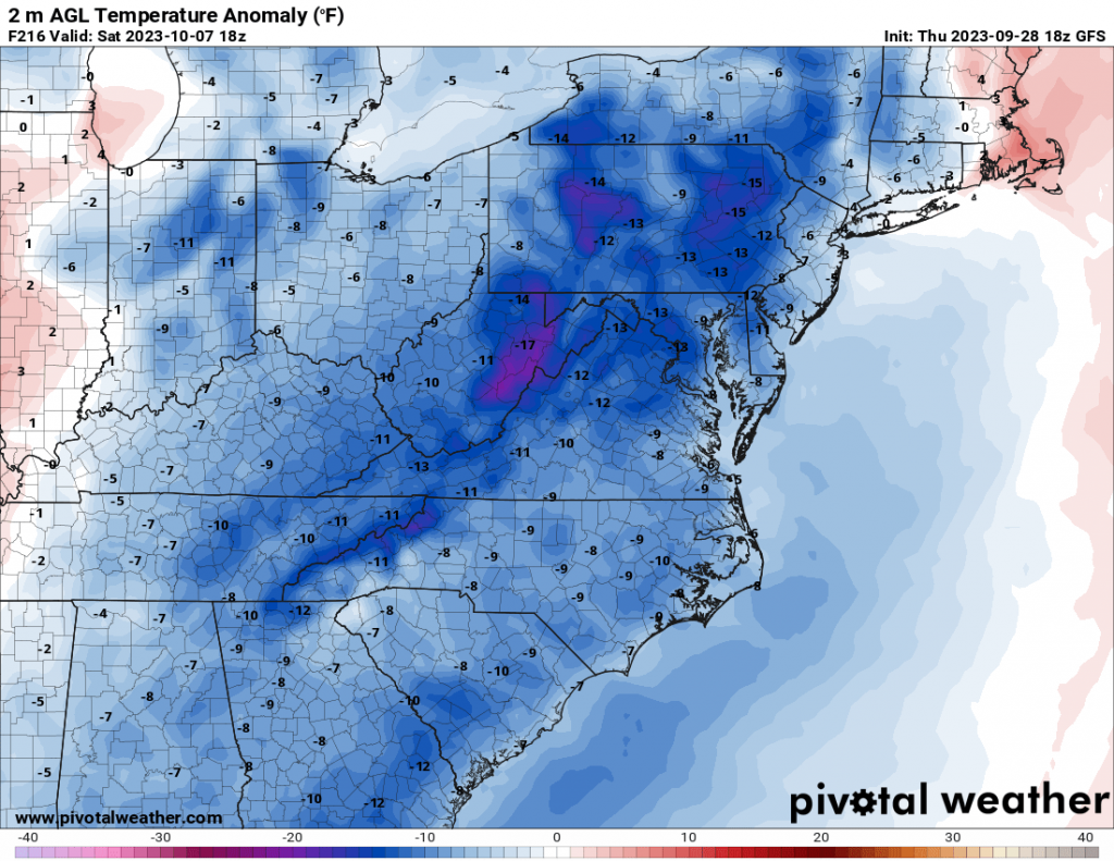
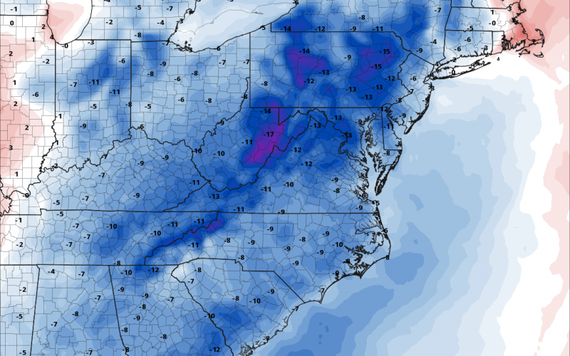
The above image shows widespread 9 to 11 degrees below average for the 7th of October. Like any cold front in the fall, it can still quickly warm up during the daytime hours shifting the temperatures from “needing to wear a coat” in the morning to “needing shorts” in the afternoon.
This couldj just be a temporary break from any lasting above-normal trends that linger into October. But at least we are not seeing any heatwaves.
Keep it right here at Carolina Weather Authority.
-Mike
You must be logged in to post a comment.