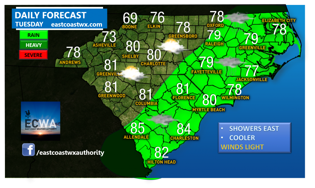
Forecast for Tuesday 6/11
Discussion:
A cold front moves through the western part of the region, thus dropping temperatures to a bit cooler values. Highs in western NC will likely only be in the low 80s at most. In eastern portions of NC/SC, rain will be present as the front will stall. Temperatures will still be cool, however they could reach the mid 80s down in SC. Wednesday looks like more rain for most of us as a wave of low pressure develops along the front and spreads rain back across the region. Have a great Tuesday!
Southeast Severe Risk for Today:
Carolina Severe Risk for Today:

Current Watches in Effect
Tropical Activity


You must be logged in to post a comment.