
Well our big storm has happened bringing heavy snow, hurricane force gusts, and extensive storm surge to the Northeast and New England. As the saying goes “beware of the ides of March,” and we are experiencing the full force as winter and spring clash. The pattern is prime with a huge Greenland block and energy moving across the nation. With that being said we are not done with winter, and winter will be going out with a bang. Yet again we are watching a storm that has the potential to, again, transfer energy to the coast and create another heavy snow event for the Northeast and New England.
Before we get into any model analysis, it’s always good to see what we are supposed to be watching and where is the energy that will effect us by the middle of the week, so let’s look!
Upper-Level WV Imagery:
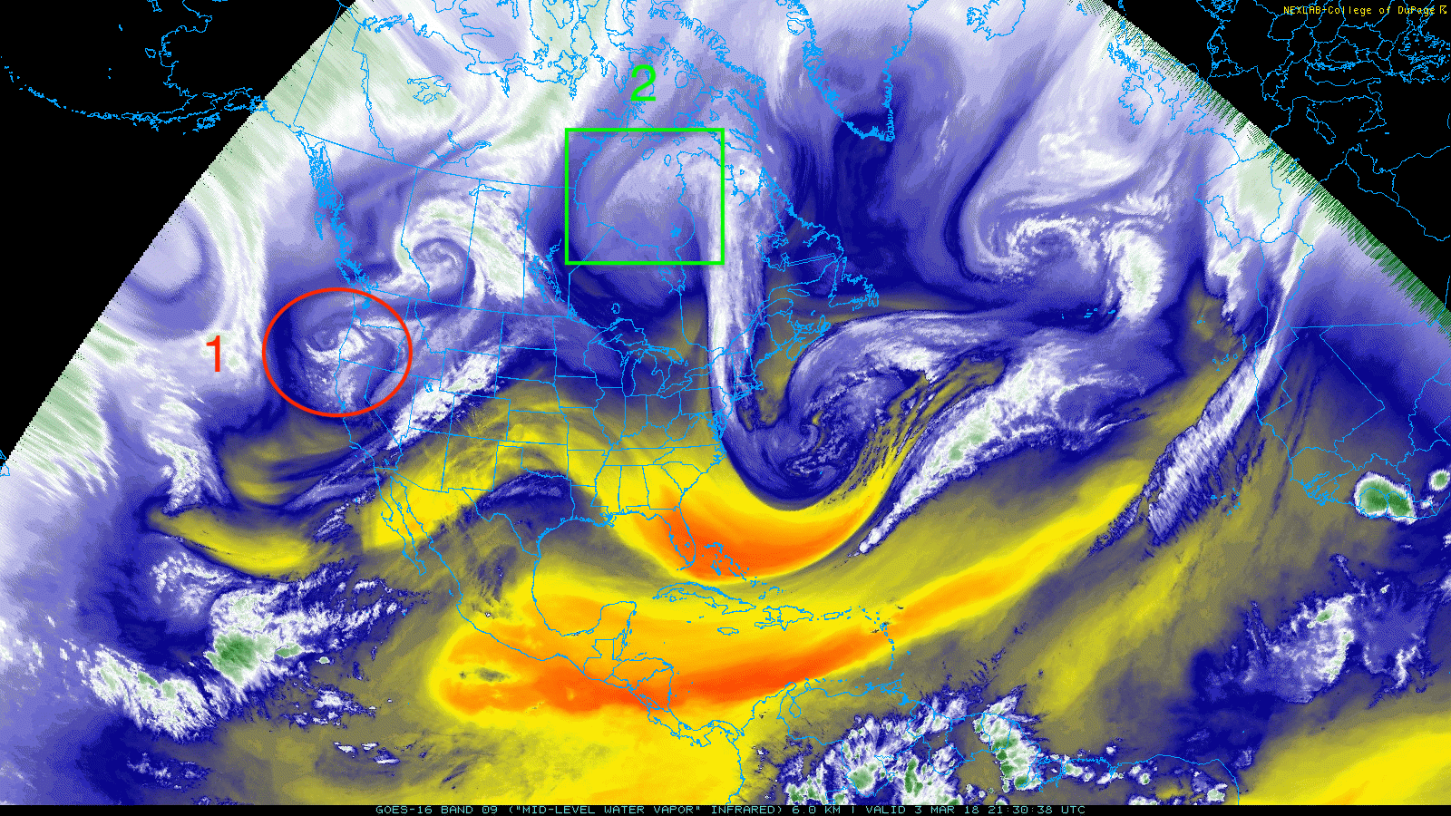
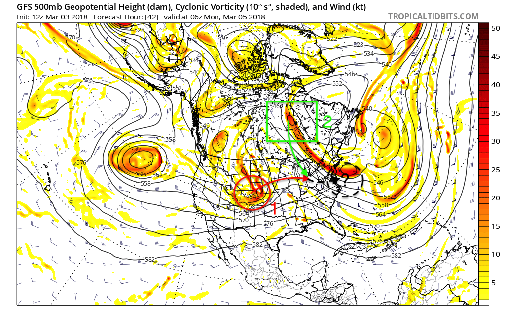
There’s our storm labeled “1,” currently that energy is bringing precipitation to the Mountain Northwest US and will move east and form a surface low pressure system in Colorado, also known as a Colorado low. Then, it will move across the Central US bringing blizzard conditions and heavy snow to portions of the Dakotas and Minnesota. After it brings blizzard conditions to the Central US it will continue east into the Ohio River Valley, and that’s where our extra piece of energy comes in labeled “2.” Number 2 is again our extra energy and our cold air injection to help force energy along the coast, just like our last storm.
Notable differences between this upcoming storm and our last one. The energy out of the west is not digging like the storm that just passed. Also, the energy coming from the north is not coming in from Alaska. There are similarities though, like our last storm we have energy coming in from Canada and that will be again our cold air injection and trigger to fire up and help transfer energy to the coast.
Now, just like our last storm the block near Greenland will yet again have an impact by helping our storm move up the coast close enough to bring some wintry precipitation.
GEFS 500mb Anomaly at 12z March 8th, 2018:
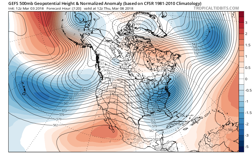
The above image is the day that coastal low will be in full force along the east coast if this model is correct. Notice the big ridge next to Greenland and that ridge will again allow our potential storm ride up along the coast close enough to bring big impacts.
Going to model analysis now, GFS ensembles are, as of now, really keying in on this storm and many ensembles have snow for coastal areas. We will have to wait for the time period that the NAM sees this storm because by that time we will have a better understanding of what is to come. Stay here with us as we get you prepared for yet another potential nor’easter!
-Alex B
You must be logged in to post a comment.