
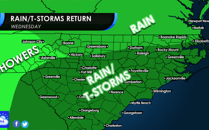
We are in an unsettled, active pattern here in the South, with rounds of persistent rain. There could be some severe storms across the Deep South on Tuesday, and that same storm system will enter our region on Wednesday.
Some strong storms may make it to more southern parts of our viewing area, and could be concentrated along the coast of SC and southeast NC. If it remains cold, the storms are not expected to be widespread severe.
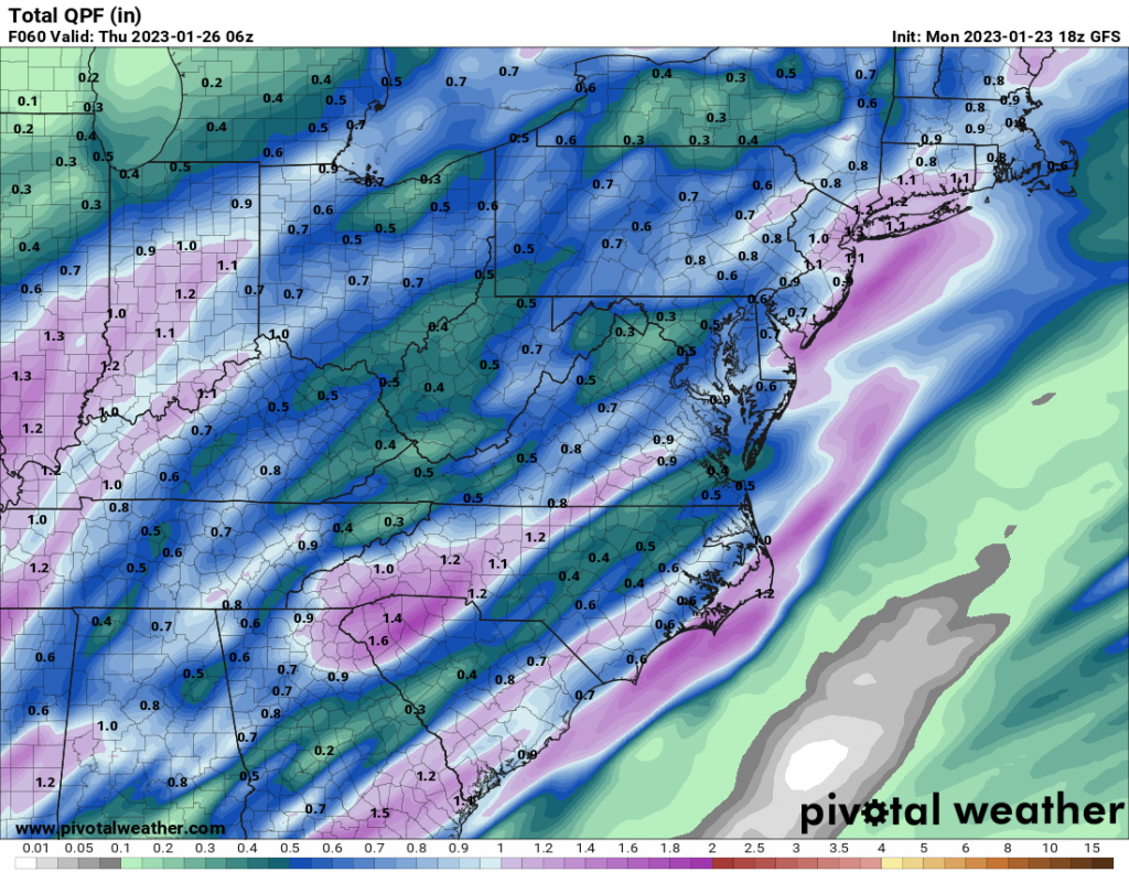
Rain totals from now into late Wednesday night are below:
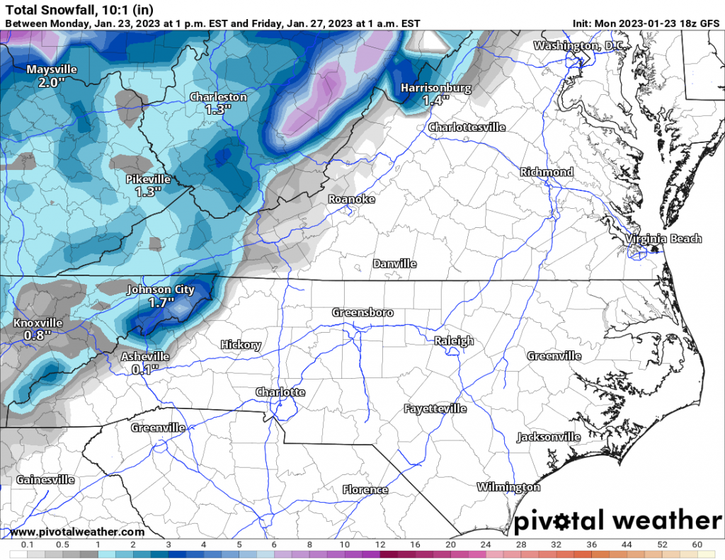
As similar with our recent system, it will turn windy and colder behind this next system as it exits, with mountain-effect snow from the winds. Some of the totals are shown below, which is into late Thursday:
So, the pattern appears to be mild and wet, as we stated weeks ago. Low pressure systems will cut up the mountains to our west, and leave us in the warm sector. This means all rain for us with each passing system. There is a chance that we could get just enough cold air for wintry precip during early February, but it only looks marginal for now.
The NC and SC Piedmonts will remain snow-starved for the near future. However, there is a chance in early February for the Southeast Ridge to breakdown, and give us an opportunity for a storm. This is only a 30% chance as of now.
You must be logged in to post a comment.