
CHILLY AIR MASSES WILL BEGIN TO MOVE IN NEXT WEEK
While our temperature trend will be on the rebound through this weekend, we are still looking at a significant cool-down next week, starting either Monday or Tuesday. This will be a significant one, perhaps a bit more in chill compared to the last front we just had.
When Monday or Tuesday approaches, we could start to see some severe weather with an associated low as it moves up the coast and out to sea. This is the low that will draw in much cooler air behind it.
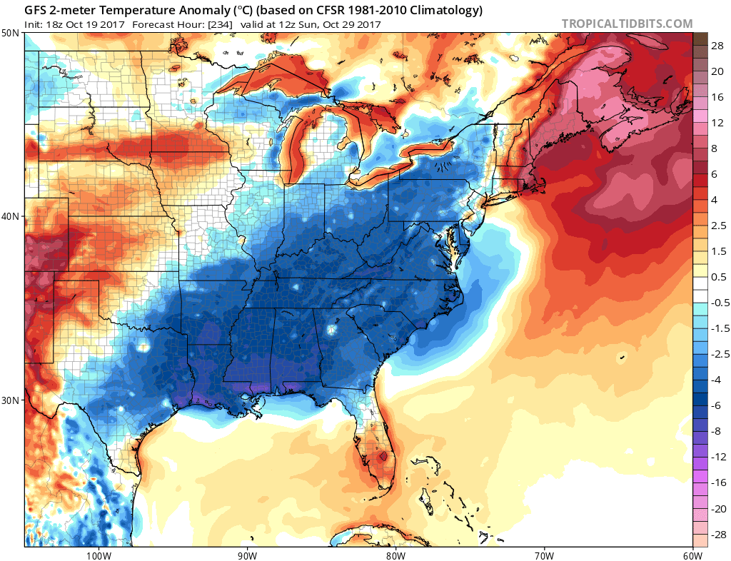
Therefore, expecting a chilly next week, and there could be an area of low pressure to watch around the 24th-25th. Below is the GFS showing below normal temperatures for many of us in the East.

As if that wasn’t enough of a cool shot, there is another one behind it that moves through around the 30th. Confidence is on the lower side as far as the strength of this NEXT cool shot moving in behind the one above. Again, there is the chance of severe weather ahead of the cold fronts and/or associated with the developing area of low pressure Sun-Tues timeframe next week. Ahead of the approaching troughs will be rain. We could start to see rain this coming weekend as the storm system gets it’s act together and draws closer. Then, behind it we will see more unseasonably cool temperatures. Overall, it’s looking like a chilly trend for Halloween!
You must be logged in to post a comment.