
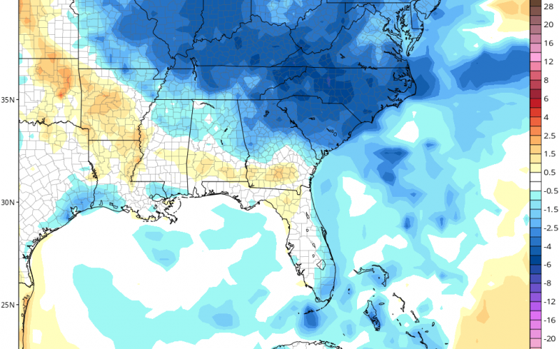
It is without a doubt one of the coolest starts to meteorological summer that we can remember. Some locations tonight in the mountains will dip into the 40s! Smoke may return Friday and Saturday, however improving air quality is expected Sunday as upper winds change direction.
Below is the Euro model for Friday, and we will be waking up to chilly temps for June. This trend is expected to also last into Saturday, but then Sunday this airmass could moderate, and go back to warm.
Model indications are overall below average temperatures into mid-month. After then, unfortunately for the cool weather lovers, there could be a rebound and we start to warm up. We will see, as this could just be model feedback for the Summer Solstice. Our forecast for June said normal temps west for the region, and below normal east.
We will see!
You must be logged in to post a comment.