
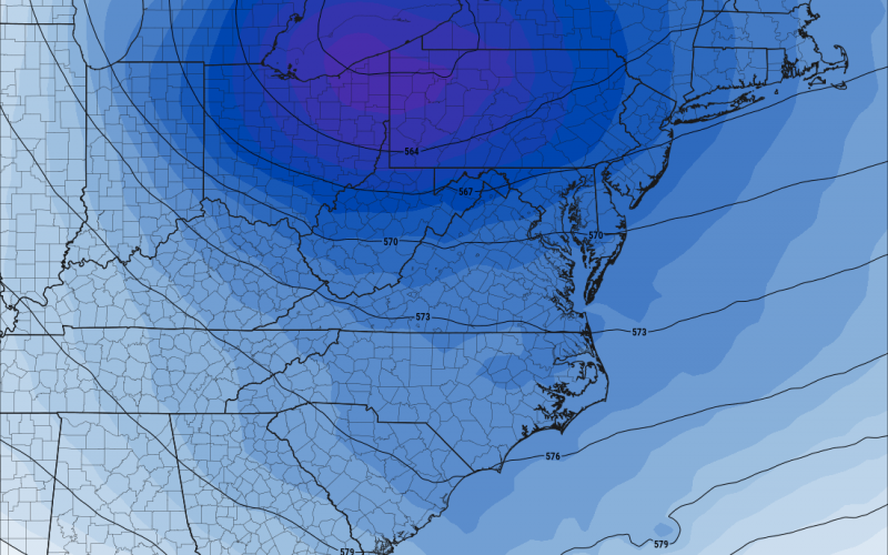
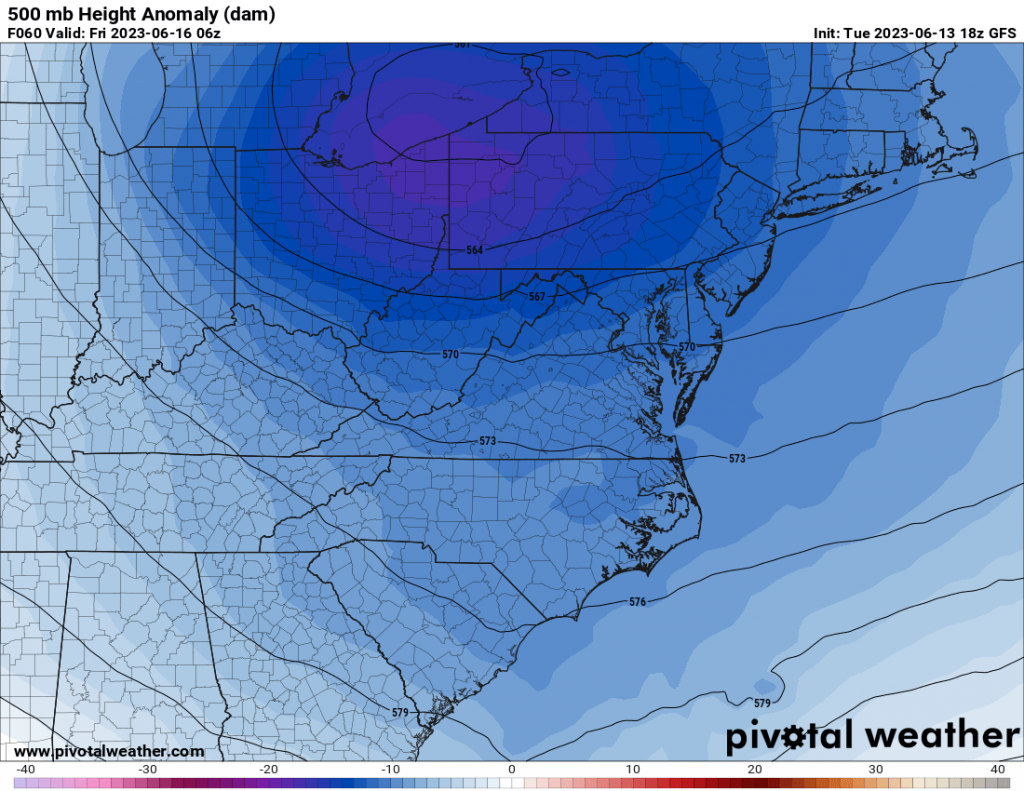
This is once again a cool weather lover’s dream, with more below normal temperatures forecasted by the GEFS ensemble mean and the GFS. It will be very hard to break 90 in some spots, but it will happen between now and the 22nd. The overall upper-air pattern shows continued cool but maybe wet at times.
Hot and dry conditions will persist in eastern Canada, which will encourage the fires to rage all summer, and even into next winter. So the pattern will be of no help to the firefighters up there.
Carolinas: Temperature trends will be overall below average but near normal at times. It won’t be unheard of for some locations to break 90 this week. But 90 might be the upper limit. We don’t see any heatwaves in the foreseeable future.
Just many marginal “good” pool days. This is ironically the same June pattern as in 2012, and the month finished HOT. But, that is not showing up in the models right now, but rather the opposite.
Enjoy for now,
You must be logged in to post a comment.