
Good news for the folks who want cooler weather in the summer. This could be the summer for you. We are looking at yet another cool outbreak anytime between the 8th-10th. A large upper-level trough will take shape over the East Coast and will bring with it cooler than usual temperatures. Shown is the GFS 500mb forecast for Sun, July 9th:
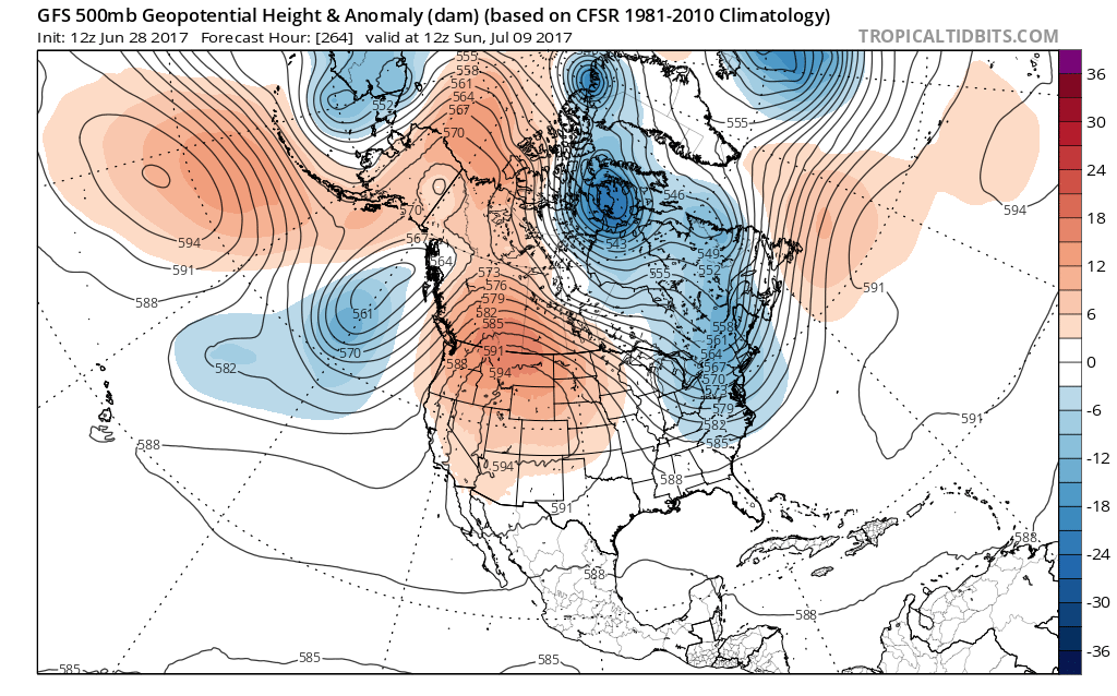
The east will be cool while the West continues to bake. They will go right back into the broiler. Although this time, it appears that the heat will shift slightly east, will include Colorado and Wyoming this time. Extreme temperatures will be forecast for those areas, especially under a 594 dm ridge. (Thats a term meteorologists use to describe how strong an upper-level ridge of high pressure is).
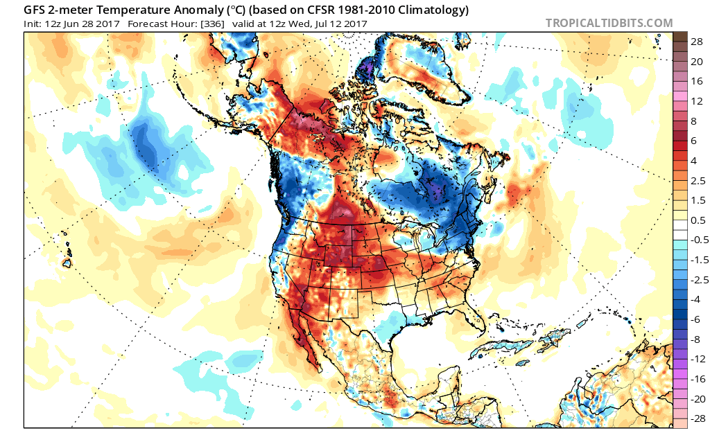
In turn, the East will see below normal temperatures, as seen on the GFS temperature anomaly:

It looks like the Northeast will remain cool, while the South will be seasonable. Not overly hot, but normal for this time of year.
As far as sea-surface temperatures go, we are looking at a neutral situation in the Pacific, as far as sea surface temperature anomalies. The ocean water will be warmer off the coast of Western Alaska than it will be along the Equator. This means that the Equator will win, and there will be less rising air over the Equator. This in turn would mean a stormier East Coast and more cool outbreaks in July.

The tropics in the Atlantic look quiet, other than a wave leaving Africa around the 4th of July. This wave might seem threatening at first, but it is not forecast to make it through all the dry air and dust. Therefore, it will not likely develop.
You may post comments below, as long as they are appropriate.
For more info and subscription services, visit: https://carolinawxauthority.com/membership-options
You must be logged in to post a comment.