
Below average temperatures are on their way for the Southeast. With storm after storm dragging down colder temperatures and a block near Greenland, the pattern that has set up is not a surprise. This pattern will keep temperatures below average for days to come in the Southeast.
With the current nor’easter marching through it will drag down below average temperatures as far south as Florida.
GEFS 2m Temp Anomaly Days 1-5:
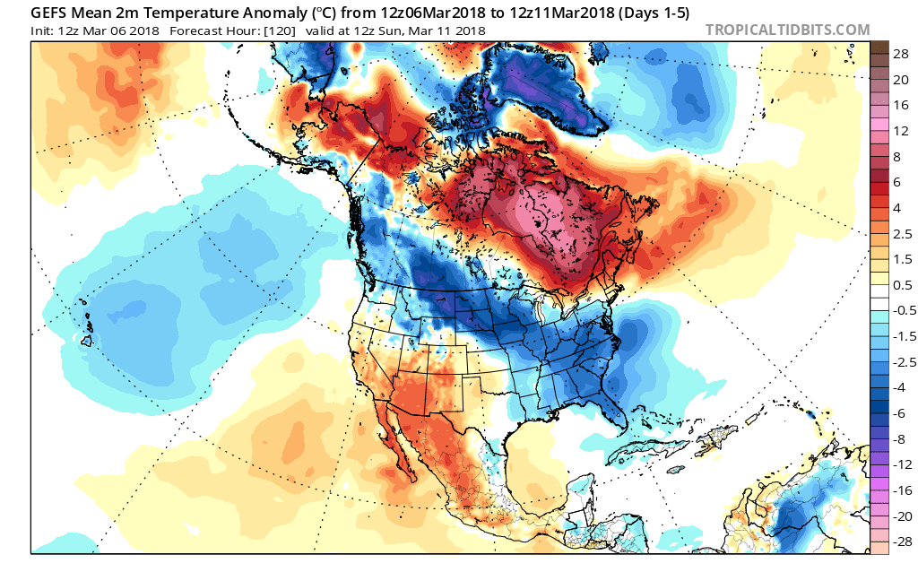
Notice the cold air feeding into the Southeast from the Central US. That cold is due to our nor’easter that gets going later tonight off the East coast it will drag down below average temperatures into the Southeast. Also, due to our Greenland block those below average temperatures will continue to be in the region.
GEFS 2m Temp Anomaly Days 5-9:
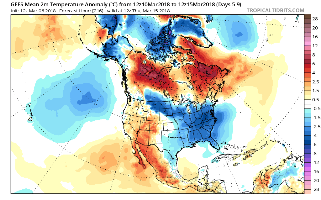
Notice how by next week the colder air is in place and continues to be in place. By the end of the run, the GEFS has cold air reloading into the Central US which is likely to spill into our region to begin April.
GEFS 2m Temp Anomaly Days 12-16:
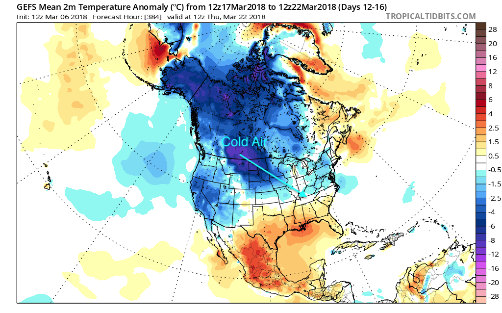
This cold air build up will put spring on pause for much of the southeast as we head into April, but for how long the cold will last is to be determined. Follow along with us here at East Coast Weather Authority to get your latest updates on weather happening near you!
-Alex B
You must be logged in to post a comment.