
It’s December, and may be a bit late for a winter forecast, however it’s better late than never. And, the fact we are issuing one a bit later than usual could be a good thing for accuracy. The theme this year is, “Just because temps are expected to be above average, does not mean below average snow and ice. Let’s show you what we mean.
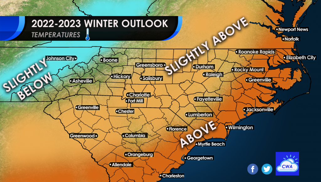
First off, let’s start with the temperature outlook for this winter. We are in a La Nina which means warm and dry across the Southeast. We think that will be the case more often than not this winter, but frequent cold shots will keep any extreme temperatures at bay. The mountains will see average and even slightly below. Along the coast, temps are expected to be above average. This is because any warm spells we get will easily send the coastal areas to above. Anywhere with no shading on the below map will be near average.
However, like we said, above normal temperatures DOES NOT always mean below average snow and ice. In fact, it can sometimes mean the opposite. Remember, the temperature forecast above is overall, as a whole.
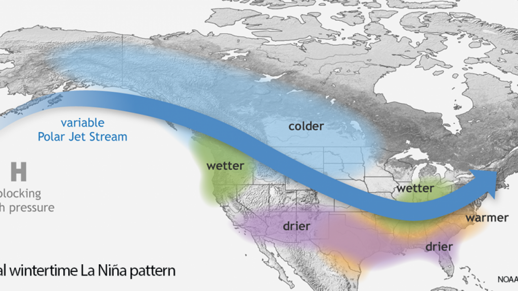
La Nina is ruling the pattern early on this winter, but is expected to die off. As many know, the below image shows what a typical La Nina is like for the Southeast, ALL WINTER. This may be more of the pattern early on, but there will be plenty of opportunities for snow and cold once the pattern goes to a La Nada, or neutral, perhaps in January and February.
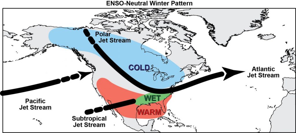
What happens once La Nina dies off? The dry pattern and warmth start to fade. Moisture starts to get pumped up from the Gulf. Once this happens and temperatures aren’t as warm, you can draw the conclusions. While overall temperatures are still above average and slight above average, the southern storm track becomes more active.
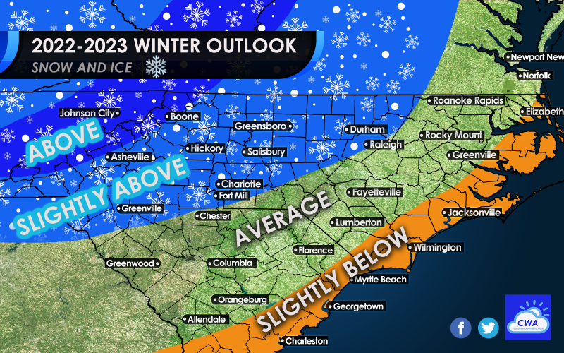
Therefore, this brings us to our final point, our snow and ice forecast below. Overall, if you live in western NC and even central NC including Raleigh, you could be in for some slightly above average snow and ice this season. The mountains will “enjoy” above average snow and ice, and should prepare for such now.
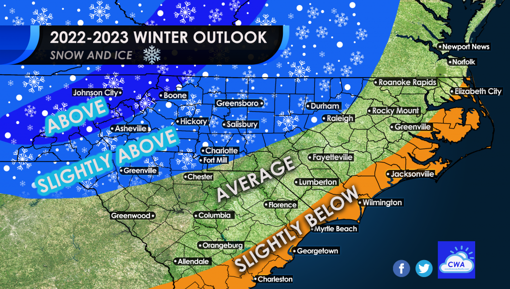
Elsewhere across the Piedmont, we are calling for average snow and ice, so whatever normal amounts are for there we can expect those. The coast this year will see slightly below average amounts. All it takes is one freak event however, for them to see average or above average amounts. But overall, this is our hunch.
This is our most level-headed guess for now, and of course is subject to change as the winter progresses. For now, enjoy the Holiday Season! I’ve yet to put up decorations, but that will change this week, if not tonight.
😉
You must be logged in to post a comment.