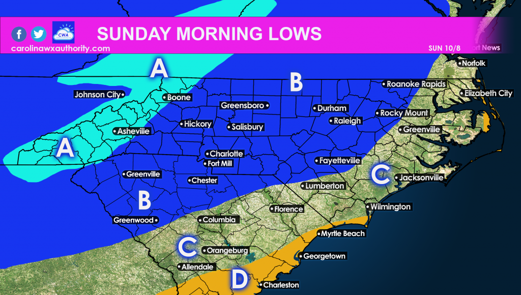
Finally, cooler weather lovers will rejoice later this weekend and into the weekend. A strong northern cold front will swing through the East Coast from Thursday into Saturday. The letters in the image below correspond to expect low temperatures on Sunday.

AREA A: Lows will be in the 30s!
AREA B: Lows will be in the 40s!
AREA C: Lows will be in the low to mid 50s.
AREA D: Lows will be in the mid 50s.
Anyone in the foothills and mountains might want to take precautions to protect plants and vegetation from frost. Again this is Saturday night into Monday. Monday morning could also be quite chilly, but not as chilly as Sunday morning.
We expect the below normal temps to last into the 14th! It’s anyone’s game after then, however.


You must be logged in to post a comment.