
As October has been off to a cooler than average start, we have been experiencing some warmer days recently. It has been dry, with beautiful abundant sunshine. There will be some more humid conditions this weekend as southerly flow comes up from the Gulf, and the remnants from Hurricane Delta make their way into our region. It will be continued warm behind the departure of these remnants, with perhaps a couple of cool shots in between, but nothing significant.
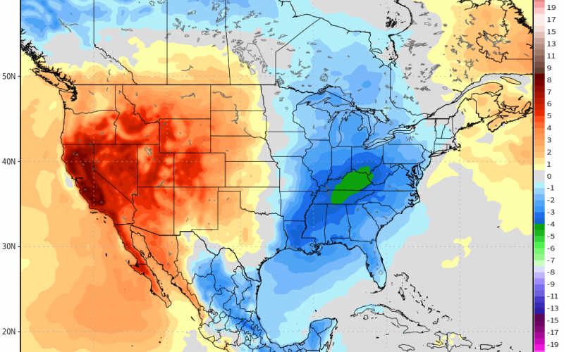
Now in the 10-day range, we are looking at what could be another shot of autumn air around the 18th. The Euro ensembles have a pretty chilly air mass spilling down from Canada to the East Coast. Some of these temperatures may be up to 10° F below normal, but it is too early to tell.

This could be another situation where nighttime lows dip into the 40s across much of NC and in the 50s across SC, with perhaps upper 30s or low 40s in the mountains. Daytime highs may not reach 70. This is not expected to be an extreme cold snap, but rather another chilly autumn airmass where you can see your breath in the air at night. These temperatures may stick around for a bit once they arrive! However, as the time gets closer we will know more.
That’s all for now, be sure to check back for updates regarding the long-range outlook.
-CWA
You must be logged in to post a comment.