
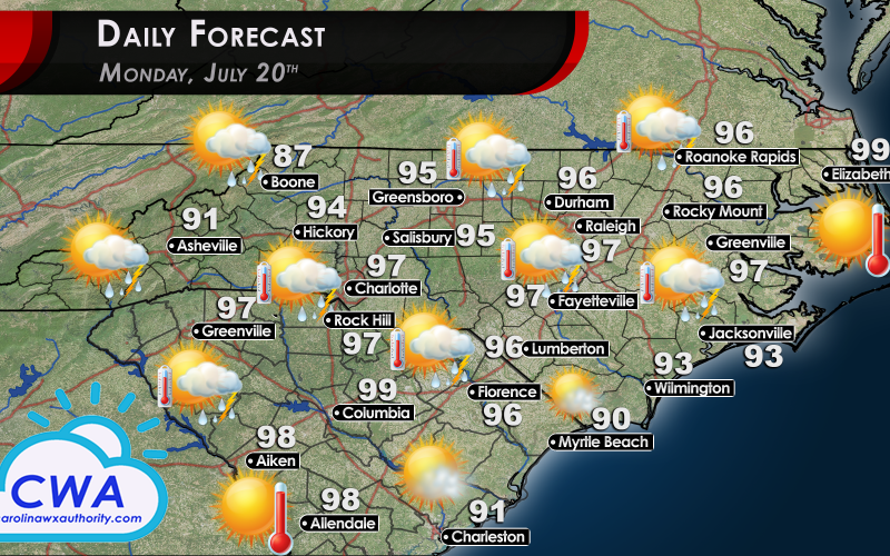
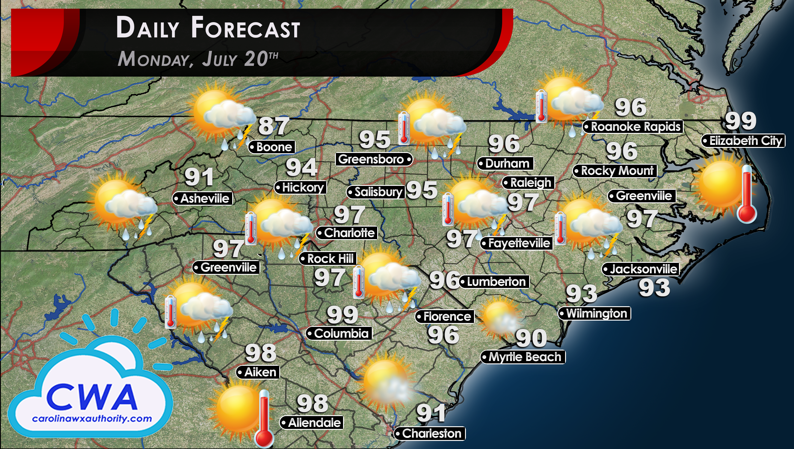
Daily Forecast for Monday: Extreme Heat Dominates Region
I am not gonna waste any time here on the Daily Forecast for Monday. It is gonna be hot. Temperatures throughout the region will be in the upper 90s for almost all locations, and several places could easily break 100°F. These air temperatures, combined with the crazy-high dewpoints, has led the National Weather Service to issue Heat Advisories and Excessive Heat Warnings for a huge swath of NC.
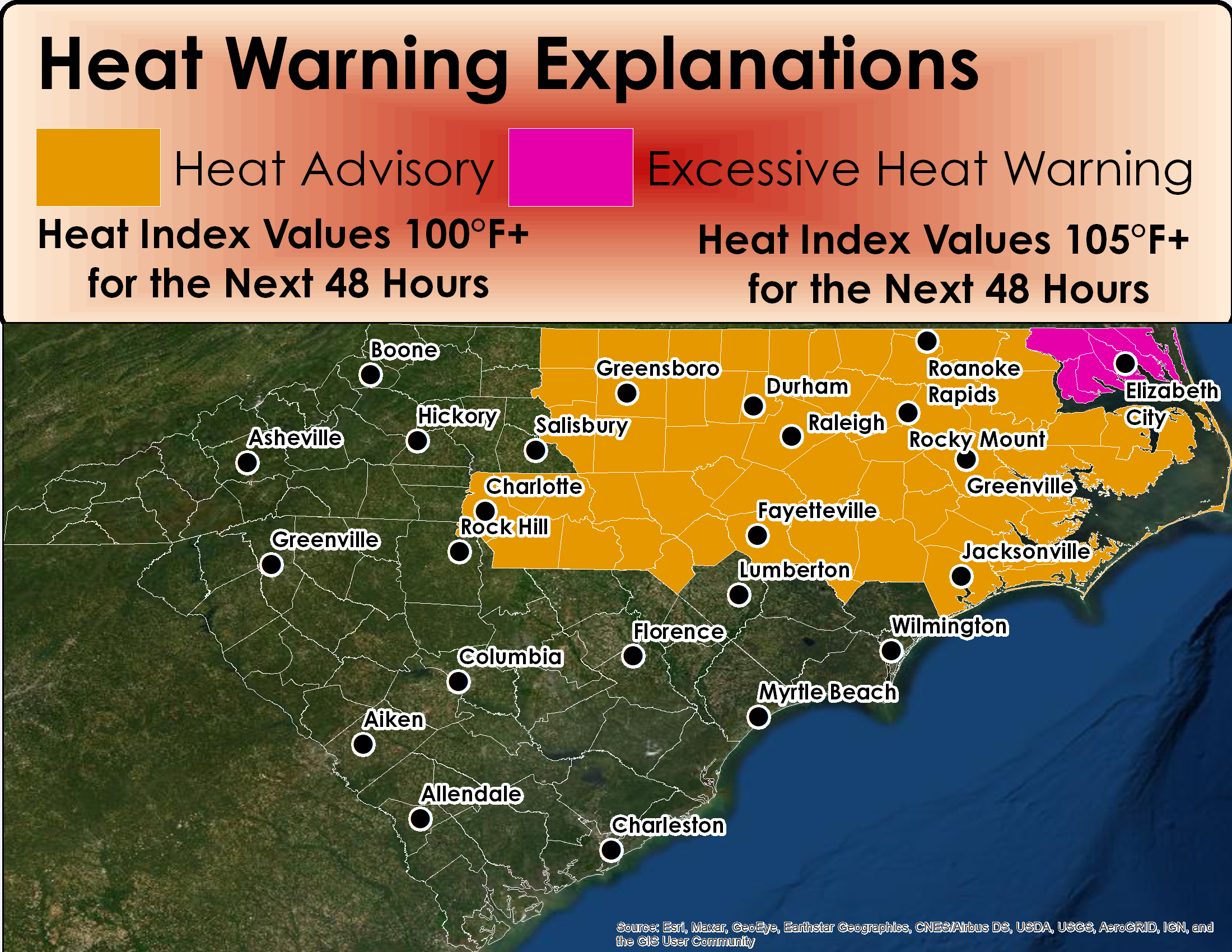
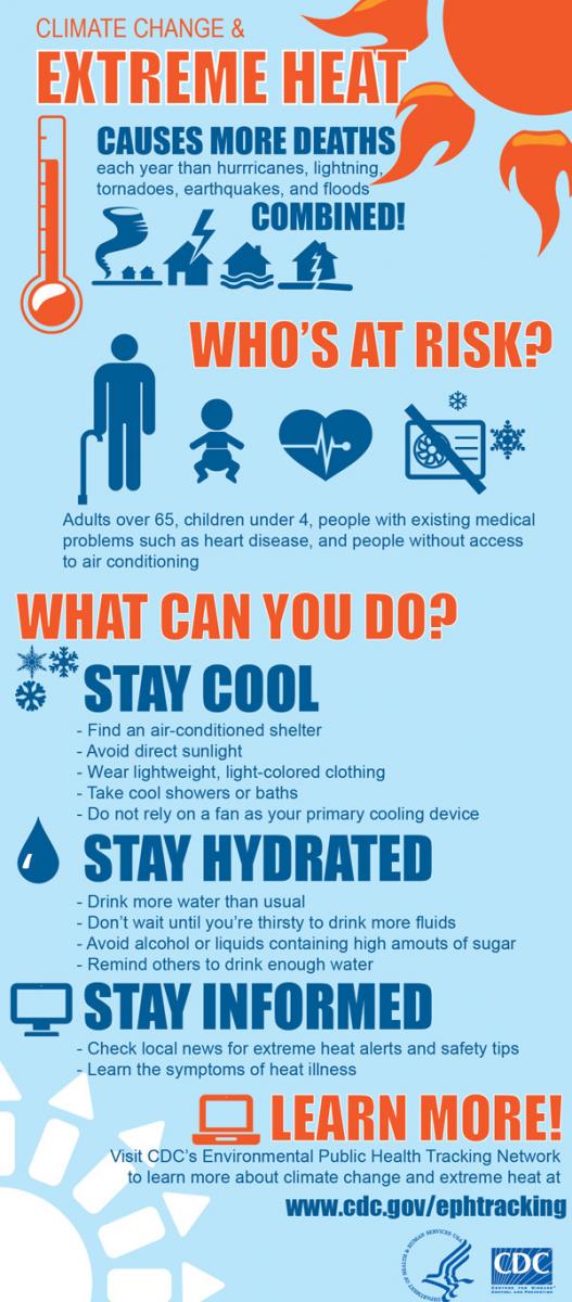
Remember, Heat advisories and excessive heat warnings mean that the heat index will be above 100°F or 105°F for 2 full days and nights. Therefore, the lows on Monday night will struggle to dip below the mid 80s, if not higher. The CDC has put out a helpful infographic (to the left) about how to stay safe during these extreme heat events. Like all images I post, you can click the image to view it full size. Finally, here are the 2pm heat index temperatures for tomorrow.
With heat like this, we will be praying for the 20% to 30% chance for thundershowers across the Carolinas. Hopefully we will see more than are forecast.

Be sure to stay safe out there. Stay hydrated and take frequent breaks!
-CWA
You must be logged in to post a comment.