
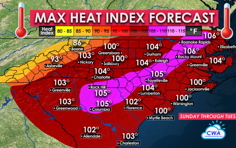
While it’s been hot recently, the worst is yet to come for the Carolinas. On Sunday, air temperatures alone could soar into the mid-to-upper 90s. The added humidity will easily cause apparent temperatures to topple 100 degrees. The worst of the heat looks to be on Sunday and Monday, and to a lesser extent on Tuesday. But each day will cause dangerous outdoor conditions. Remember, it does not take long to become dehydrated with these kind of conditions.
The worst of the heat is expected to be inland, from central SC into eastern NC and up into VA including DC. Heat indices are expected to be 105 °F or greater. The beaches will be hot, but not as hot as inland with this heatwave.
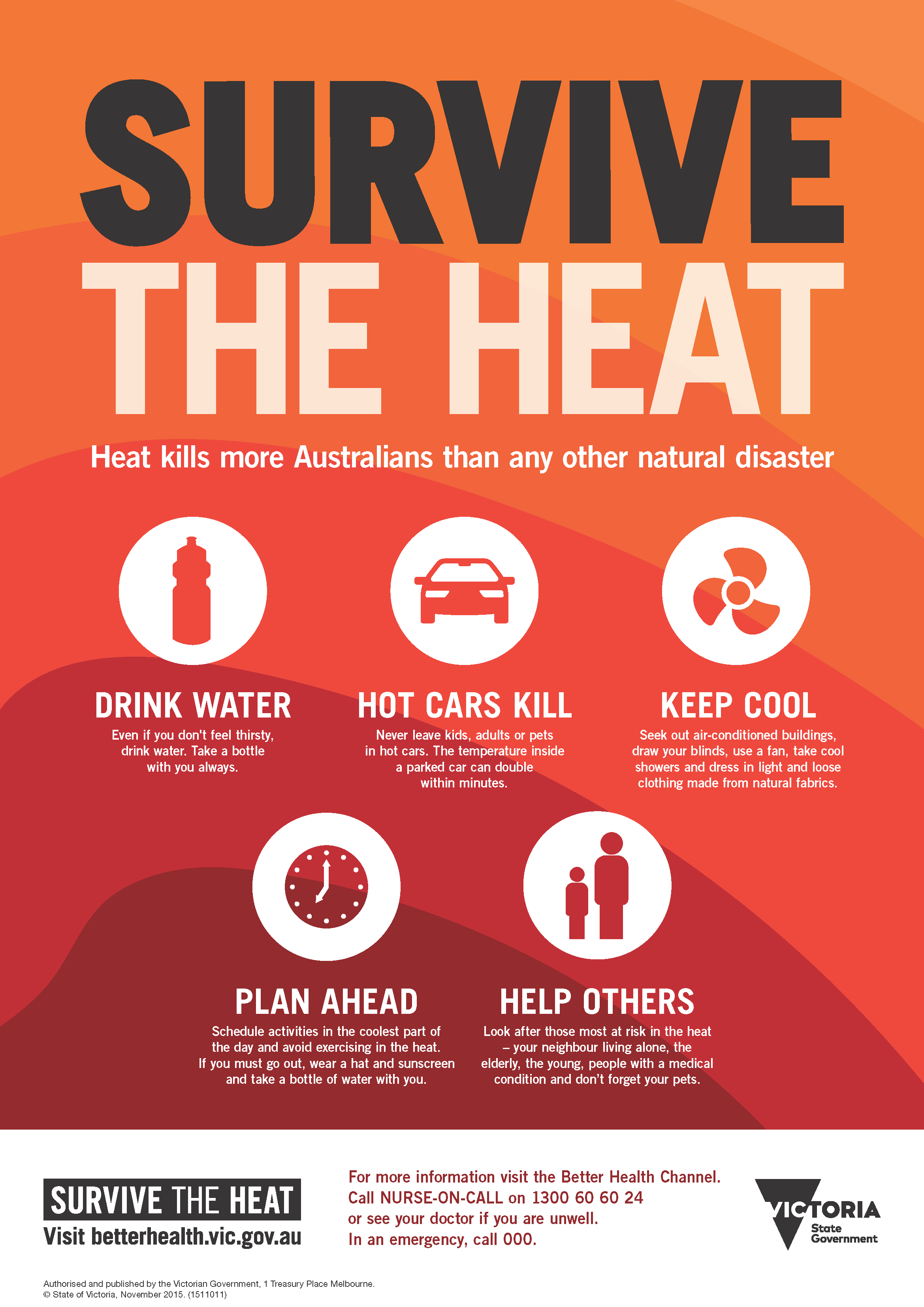
Make sure that no child or pet is left unattended in a car for any amount of time. Make sure to drink plenty of water and to stay hydrated.
Below are some safety tips on how to navigate a heatwave. It is really about planning and limiting time outdoors and hydration, as well as not leaving kids or pets in hot cars/trucks.
Take it slow and easy if you must be outside starting Sunday!
-CWA
You must be logged in to post a comment.