
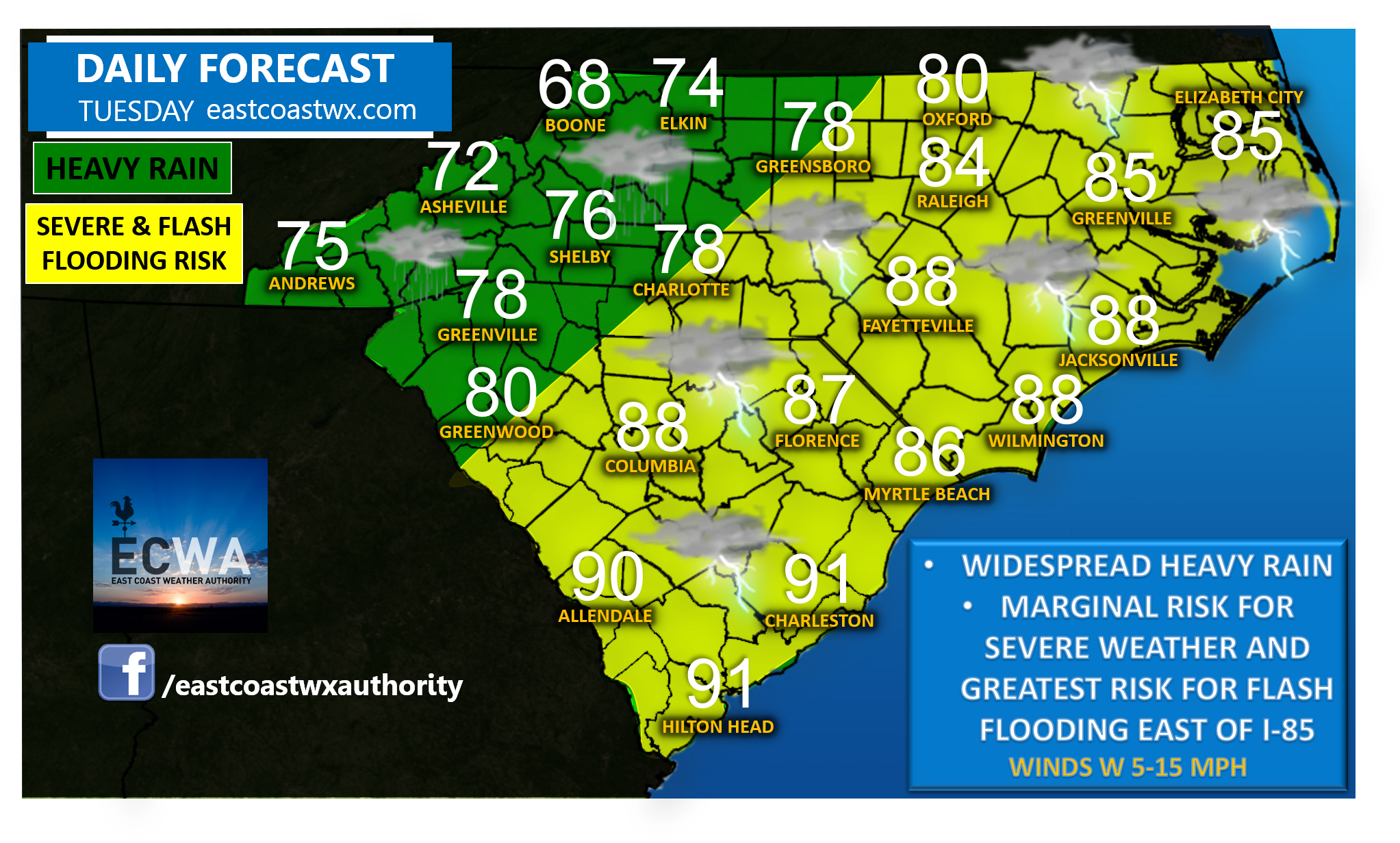
A cold front will bring about widespread showers and thunderstorms Tuesday, and provide at least a low risk for flash flooding everywhere. Rain will be most prevalent in the western Carolinas in the morning, migrating eastward through the Carolinas for the afternoon and evening hours.
Slow-moving and heavy thunderstorms will be most likely along and east of interstate 85 where the risk of flash flooding will be at it’s highest potential. Not everyone will experience flash flooding, but scattered areas of flash flooding are expected. A few storms may also become strong to severe with strong winds and spotty hail possible, but lightning and torrential rainfall will be the most likely threats.
Despite the undesirable amount of rain, the good news is that this cold front is just around the corner. Our temperatures will be taking a nosedive, so at least some relief is on the way soon for everyone.
Stay safe on this rainy summer day as flash flooding can occur quickly at any time for your area with little to no warning. Make sure you stay tuned for the latest information regarding the potential for flash flooding and low end severe threat heading into Tuesday.