

Low-level closed circulation has closed off today which has made Invest 94L become Tropical Depression 3. Maximum sustained winds are at 25 knots or about 29 mph. Additional strengthening is likely, although it won’t be too much. This will likely be a rainmaker this week for the Southeast Coast. A powerful cold front moving across the region on Tuesday will bring much cooler air and could have an impact on the fate of TD3.
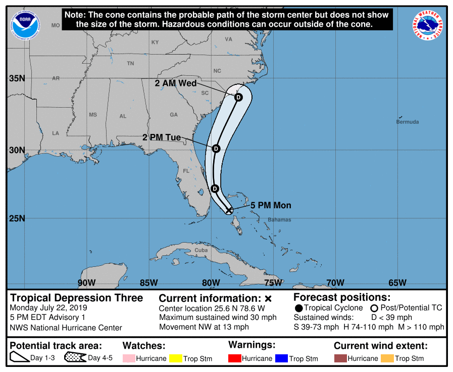
The depression could get caught up in the tail-end of the front, and could strengthen further, or it could get swept out to sea. It all depends how strong the front is once it moves offshore. If it’s weak, then it could cause TD3 to slightly intensify.
The GFS is not quite so enthusiastic and has a blob of rain along the coast into Friday. If anything this will be beneficial rain for dry areas. Nothing to be alarmed about for now!

Thanks for reading! If you liked this post please share with friends and family using the sharing buttons below!
Mike Griffith
Meteorologist at Carolina Weather Authority
You must be logged in to post a comment.