
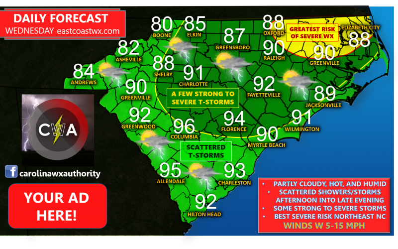
Partly cloudy and hot conditions can be expected for your Wednesday with scattered showers and thunderstorms developing. An initial line may effect part of Western North Carolina and Northwestern South Carolina in the morning, but will likely be fairly broken after crossing the mountains, and will likely dissipate considerably as it reaches the Piedmont. Showers and thunderstorms are likely to re-develop with passage of a cold front in the late afternoon and evening hours. Be alert to the possibility of a few severe storms in Northern South Carolina into much of North Carolina, with the greatest risk of severe weather in Northeast North Carolina.
The main threats associated with any thunderstorms Wednesday will be strong winds, hail, dangerous lightning, and heavy rainfall. However, we cannot rule out a tornado or two, particularly in Northeast North Carolina where parameters suggest this is most likely to occur.
Make sure to stay tuned for the latest severe weather information here on the site, as well as our Facebook and Twitter pages for watches and warnings.
Have a great Wednesday and stay safe.
-Jesse
Carolina Weather Authority