
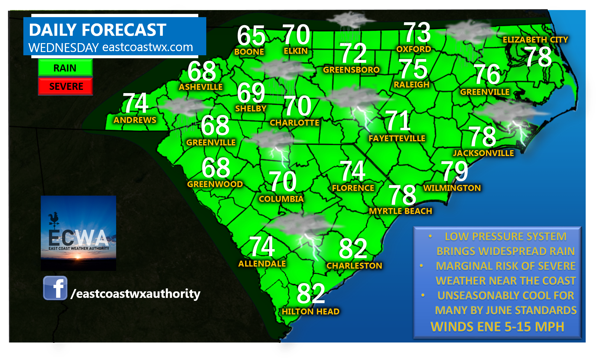
We’ve got a very wet and unseasonably cool setup for your Wednesday as a low pressure center works its way up the East Coast with numerous showers and thunderstorms. High pressure to our northeast will actually funnel in cooler air over much of the western and central areas leaving us some 20 degrees or more in spots below our climatological standards for daytime highs in mid-June. Where was this setup this past winter? It would’ve been a wintry one.
Another point of interest to watch for is our severe weather risk near the coast. Parameters suggest a few storms may be capable of high winds or a brief tornado from Charleston to Kitty Hawk. This is only a low risk, but not zero.
Thursday is looking pleasantly warmer. Have a great Wednesday.
-Jesse
East Coast Weather Authority
You must be logged in to post a comment.