
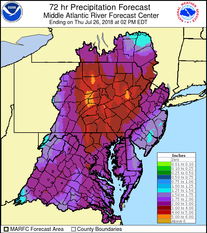
Parts of PA are already under water, such as Hershey Park. This flooding event is only about halfway over. Many other parts of PA especially the mountains are under the gun for some extreme rainfall rates and impacts. Landslides and dangerous river flooding is likely. Tropical air is making its way up the East Coast which is a feeder for all of the rain activity. A high pressure system over the Atlantic is helping to steer the moisture up the coast.
The rain will not end over the next few days, and could continue into this weekend. This is not good news for anyone who lives near a major river, creek, or stream.
WPC rain totals through the 30th are indeed epic and could cause a state of emergency in PA.

Residents are urged to not drive into flooded roads as the water may be deeper than thought. Cars are swept away by flood waters every year. Don’t be one of those victims. Instead, turn around or take another route.
The rain should eventually subside, but flood waters will continue long after the rain has ended. Have a plan of action for your safety, and seek higher ground especially if the NWS instructs to do so. Monitor your local news station and NWS office for statements.
Above all, stay safe!
East Coat Weather Authority
You must be logged in to post a comment.