
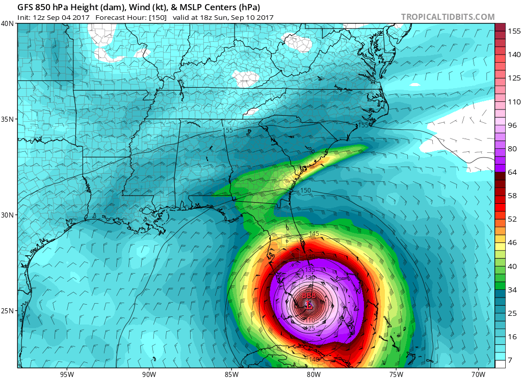
Our favorite forecast model, the Euro, takes Irma on a drastic turn to the north just before she would hit Florida. This would mean that she would stay just offshore, but brush East Florida and South Florida with impacts that should still be taken very seriously. Since she would remain offshore and move north, she would remain a powerful hurricane. 931mb for a Hurricane would be stronger than Harvey. We could be looking at a situation similar to Matthew, but just not with confidence yet.
Sunday, Sept 10th, by 8pm:

Then, Irma would move into the waters off the Southeast Coast, and then would make landfall around Myrtle Beach, SC or Wilmington, NC.
By 8pm Tues Sept 12th:

This is still subject to change, since the GFS has a HORRIFIC landfall right around Miami as a maximum Category 5 hurricane. With these trends, residents in South Florida need to pay SPECIAL attention to this, and start to prepare with essential life items and an evacuation plan!
Please if you haven’t already, sign up for our monthly subscription for 5.50 a month by clicking here
You must be logged in to post a comment.