
5-20-2017
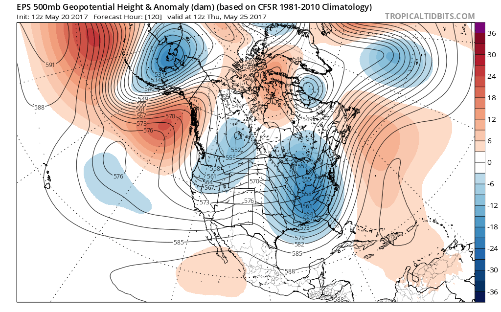
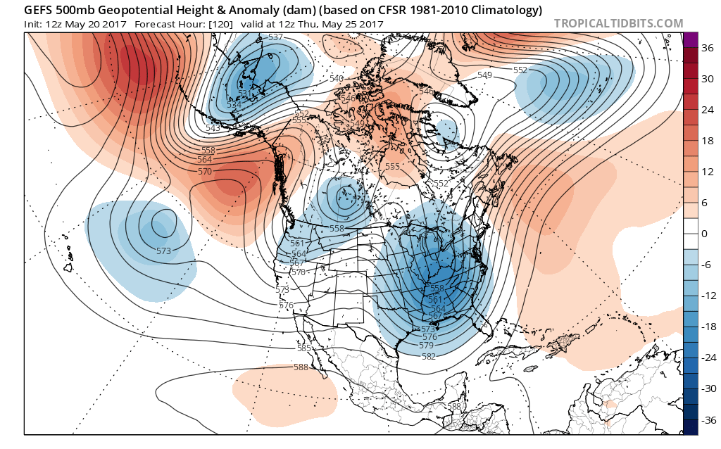
The Euro ensemble 500 mb height anomaly is showing a fairly deep trough in the East late next week, which would signify below normal temperatures for this time of year. Also, this would mean stormy and rainy. The rain and low clouds will likely keep us cool.
After this trough lifts out, it looks like the start to June will be seasonably warm, with no upper ridges or heatwaves in sight. This is likely attributed to the active southern branch in the jet stream, which pumps moisture up the East Coast, and thus causing rain and storms.
On the bright side, for snow lovers, if the southern branch of the jet stream stays active into winter, that would mean a busy winter for most of us!
Mike G.
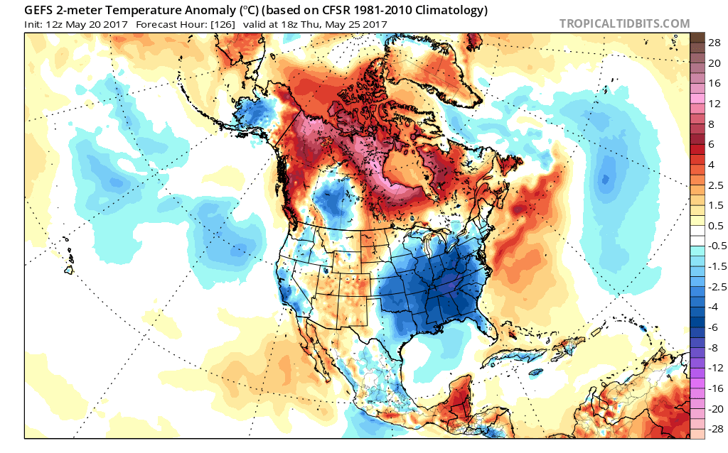
There warm air all around new jersey.unless there’s a low above us,where is that cold air infiltrating from?
Basically low pressure, the jet stream, and Canada.
So you are correct about an upper level low going to be above you.