
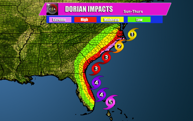
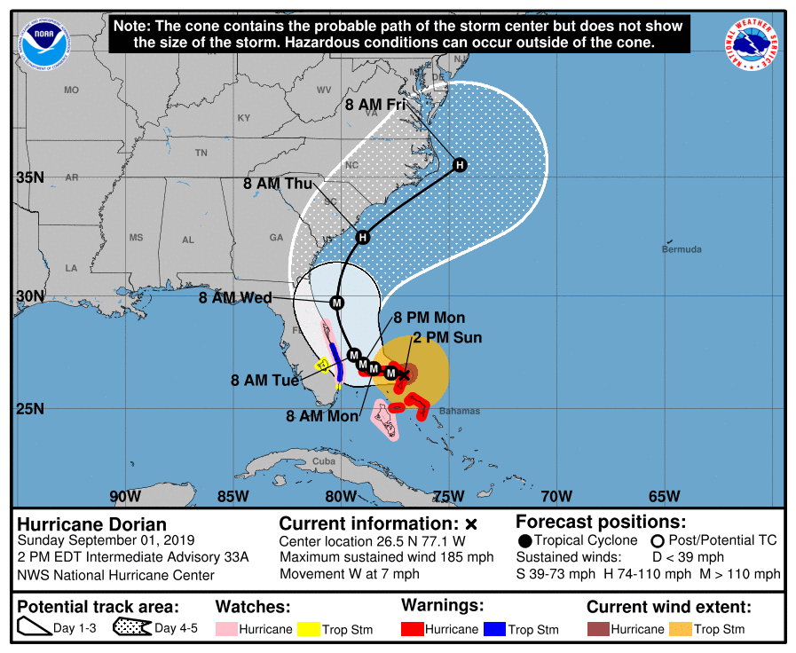
Hurricane Dorian is an extremely powerful and dangerous Category 5 hurricane, with sustained winds in excess of 180 mph. Gusts to 220 mph are possible in the Bahamas today and tonight! Dorian is expected to slow down and then eventually turn north on Monday and Tuesday. High impacts are expected for the Florida coast in the way of high winds and flooding rains from the outer rainbands, and perhaps even the western side of the storm.
When Dorian moves farther north, shear is expected to take hold and weaken the storm. While he may be a Category 4 near northern Florida and Georgia, he may start to weaken as he pulls north. Myrtle Beach and Wilmington, as well as eastern NC and the Outer Banks, and southeast VA are expected to have high to extreme impacts. Landfall is expected somewhere in NC, however DO NOT rule it out in SC!
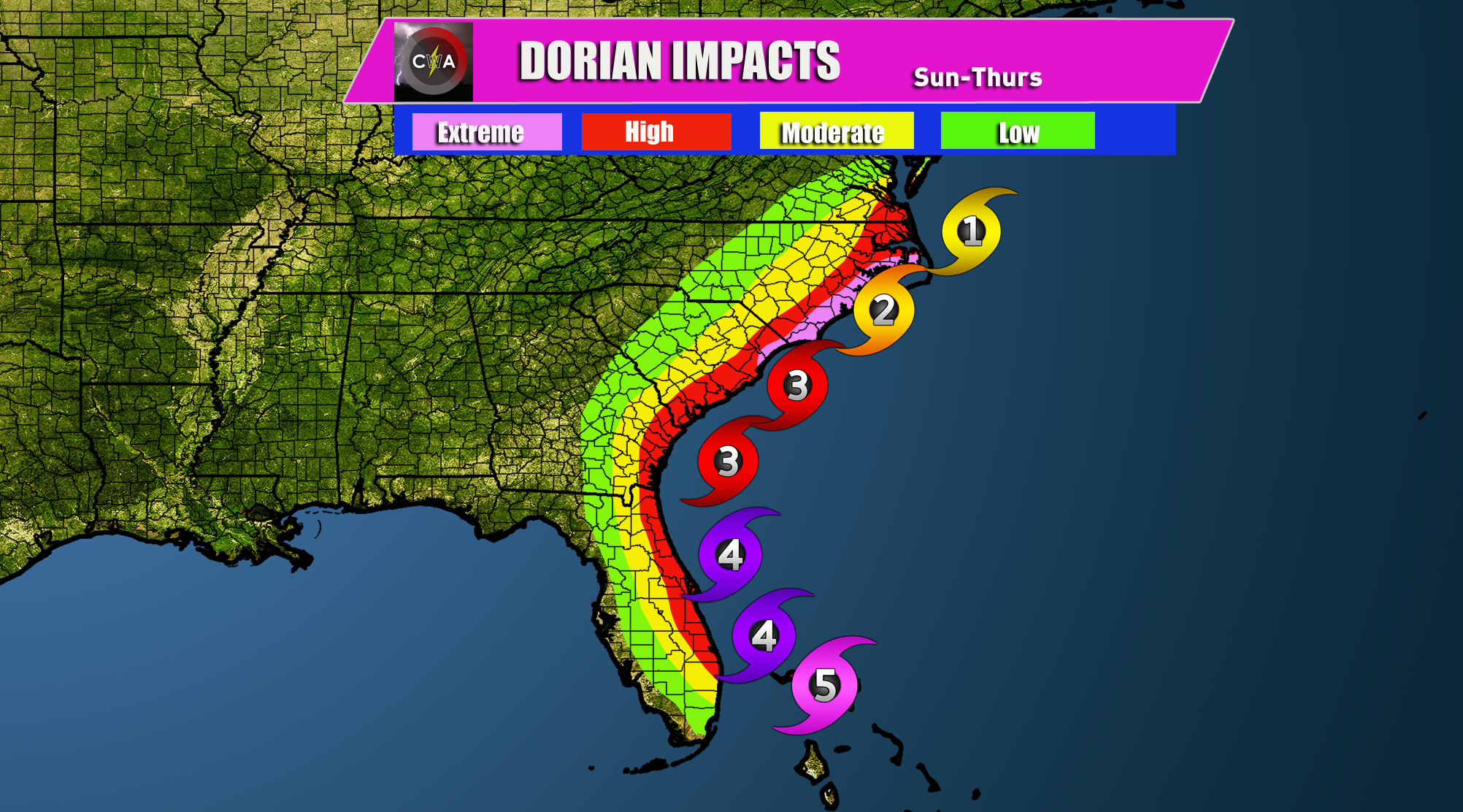
The NHC forecast cone of uncertainty is still very wide, which really isn’t that helpful. Expect a close call with the Southeast Coast in the coming days. Landfall is looking more likely as this storm will likely NOT turn out to sea.
Stay tuned for all the latest and check the models for yourselves ~~~> carolinawxauthority.com/models
You must be logged in to post a comment.