
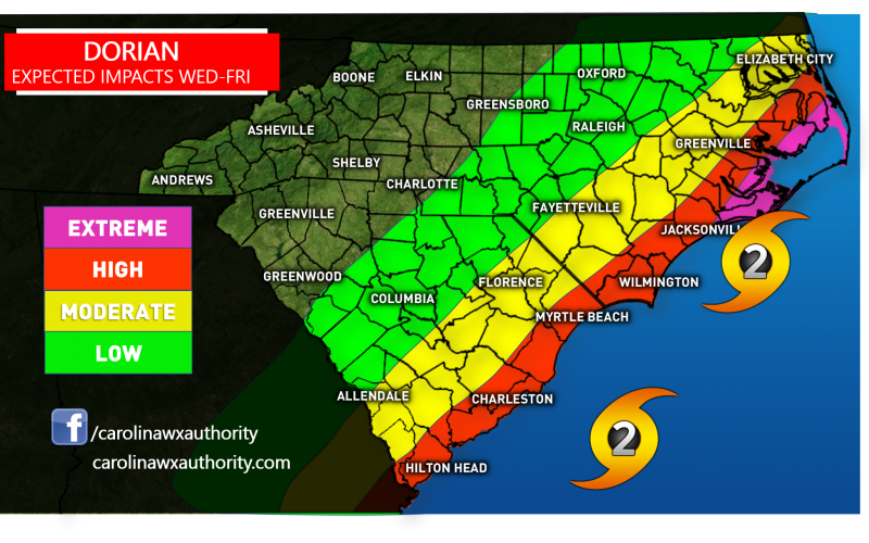
Hurricane Dorian is currently a Category 4 hurricane sitting just off the Florida Coast this Labor Day. Forward movement is expected to be small, as he begins his ever so slight journey northward. He is expected to weaken some as he gains latitude, which is somewhat good news for the Carolinas. By the time he reaches South Carolina, he is expected to be a Category 2 hurricane, which is still significant. Rip currents and coastal flooding will still be impacts even though the hurricane will be offshore.
However, we are expecting landfall this week somewhere along the Outer Banks. We can expect a Category 2 storm. Damage to structures as well as flooding can be expected. Residents who have been ordered to evacuate should do so, even if it means ending vacation plans early.
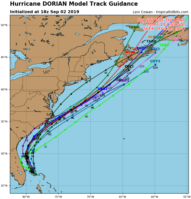
The forecast ensembles keep Dorian offshore fo the most part, but a cluster take him into the Outer Banks, which is why we think he makes landfall there. Keep in mind the effects of the storm will extend well beyond the western side of the eye, and will be felt inland.
Stay safe and heed all orders from your local government concerning preparations and evacuations. Stay with us here at CWA for the latest updates
Also stay up to date with our models page ~~~> carolinawxauthority.com/models
-Mike G.
CWA Meteorologist
You must be logged in to post a comment.