
As many of you may have heard, Florence has been eyeballing the East Coast as far as a potential landstrike. While we are not certain of the exact location of a landfall, residents along the East Coast need to closely watch Florence over the next week. There is a big higher concern in eastern NC and VA. This may change over the next few days as new data comes in. There is absolutely NO reason to panic right now, as there are some tracks in the ensembles that take her out to sea.
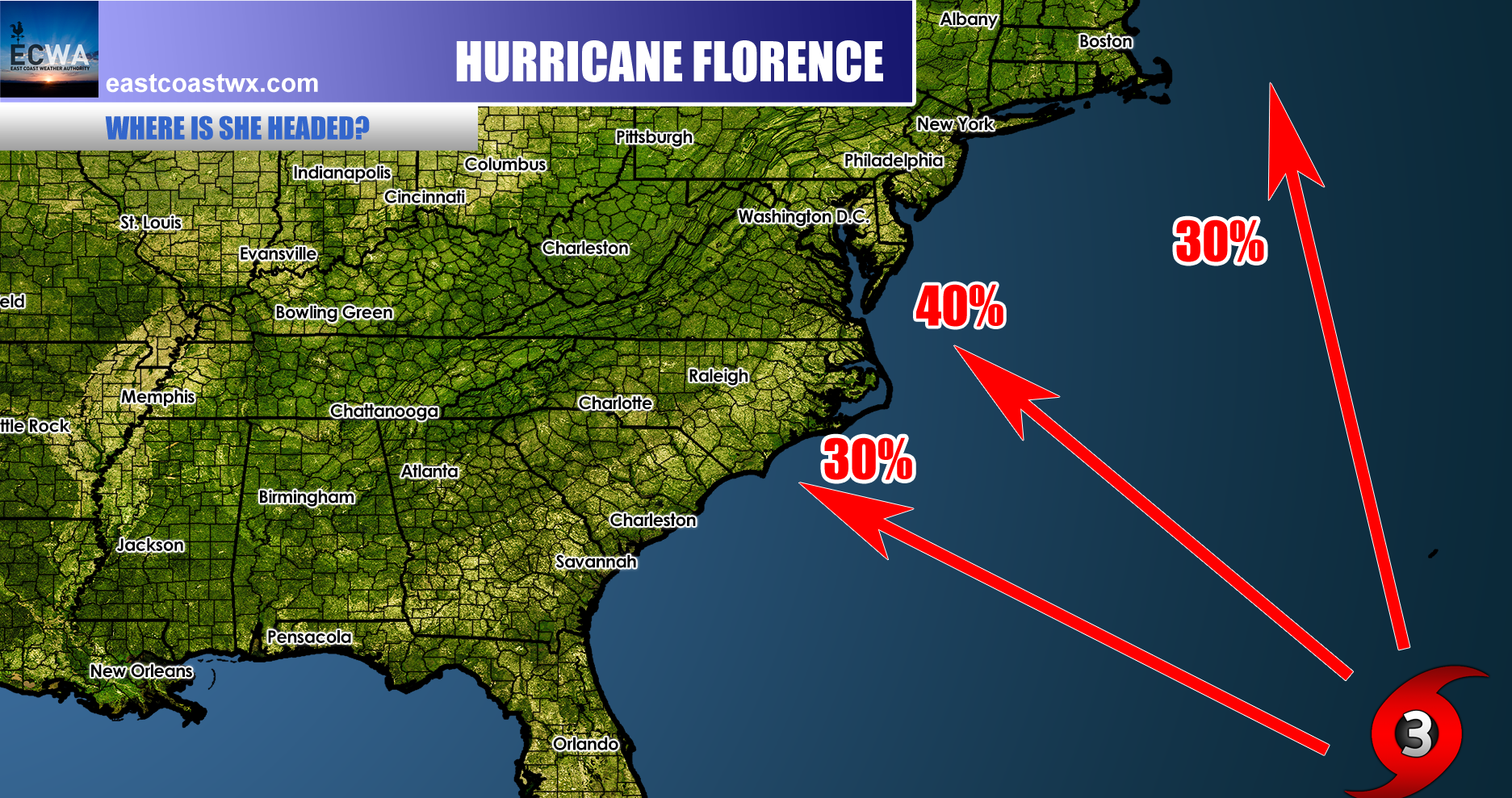
However there has been some moderate agreement with the global models such as the GFS and Euro of where she will be about a week from now. Currently as of Thursday afternoon, Florence is classified as a Category 2 hurricane with winds of 105 mph. NHC now has her on a more westward track which brings moderate levels of concern.
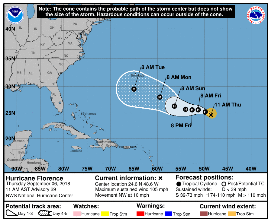
Due to the overnight models, residents in eastern NC and eastern VA should closely monitor every advisory that the NHC issues. We hope that Florence will turn out to sea. It is not safe to stop monitoring the situation until the all clear is given.
Consult your local NWS office for official information. Stay with us here at East Coast Weather Authority for the latest!
For more detailed info and updates, consider subscribing:
You must be logged in to post a comment.