
It’s been since late March that we’ve seen a prolonged stretch of warmer than average temperatures in the Carolinas for more than just a few consecutive days. After a cool and wet several weeks, we are finally going to see the tables turn as high pressure aloft builds east.

While many of us felt the change today and will again tomorrow, temperatures will moderate as a cold front drops southeast into the region, upping our chances for precipitation for the second half of the week. However, temperatures should quickly rebound heading into the final weekend of June. It probably won’t be enough to get monthly average temperatures on the plus side, though.
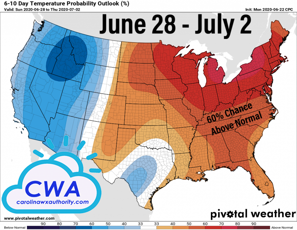
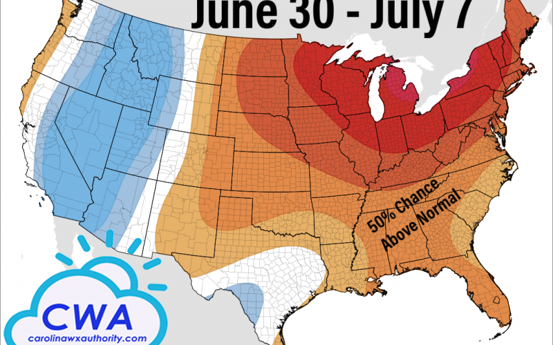
By the weekend, we are likely to see prolonged warmth which lasts into the beginning of July. Most places outside of the beaches and mountains will have several days reaching the 90s in the afternoons, and perhaps even a 100 degree high or two in the normally hot spots in the South Carolina Midlands. Record highs aren’t quite so likely this far south, but could occur further north across the Great Lakes and Interior Northeast, and Central Canada.
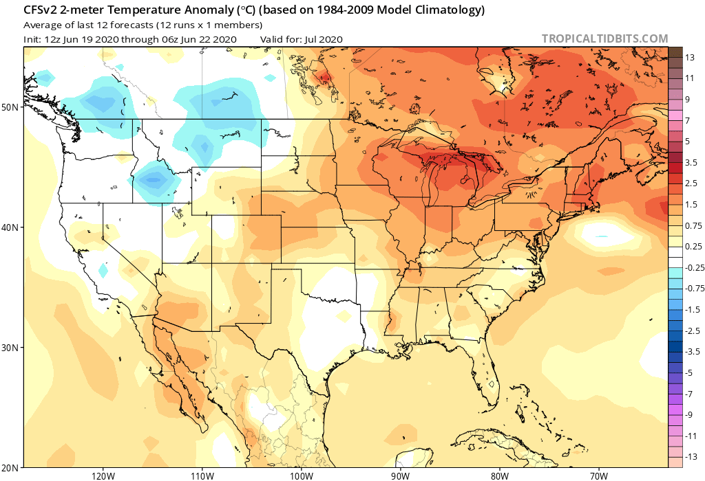
CWA subscribers should not be surprised to see a warm forecast map for July – we’ve been predicting a warmer, wetter summer than average. We haven’t yet seen the prolonged warmth, but the climate forecast system is on board with a warm July. The first half of July could be particularly warm and we’ll likely see our hottest days of 2020 during that stretch.
The cooling of the South Pacific waters correlating to La Nina that developed earlier this month is shifting our weather patterns. La Nina tends to lead to hotter, drier weather in the Southeast. We aren’t latching on to a developing drought any time soon, but July should not be nearly as wet compared to normal as this transition takes place. We also need to watch the Gulf and Caribbean for tropical trouble in July.
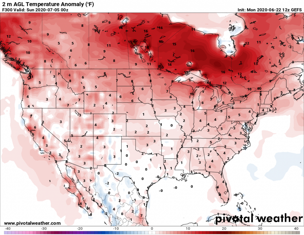
And finally, the July Fourth holiday and weekend are expected to come during what could be some of the hotter days of this prolonged hot spell, depending on cloud cover and precipitation. Last year’s July Fourth was awfully hot and humid and the sky opened up in the afternoon in places like Fayetteville. While it’s too soon to say where and when it might rain this year, the heat and humidity we had on 2019’s Independence Day will likely be replicated this year. So a trip to the beach sounds like a good idea!
We’ll continue to fine tune the forecast for July Fourth in the coming days, with more articles, Facebook posts, and YouTube videos. Please check back with us if you are planning to be outdoors, and remember to properly hydrate yourselves!
-CWA
You must be logged in to post a comment.