
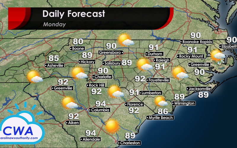
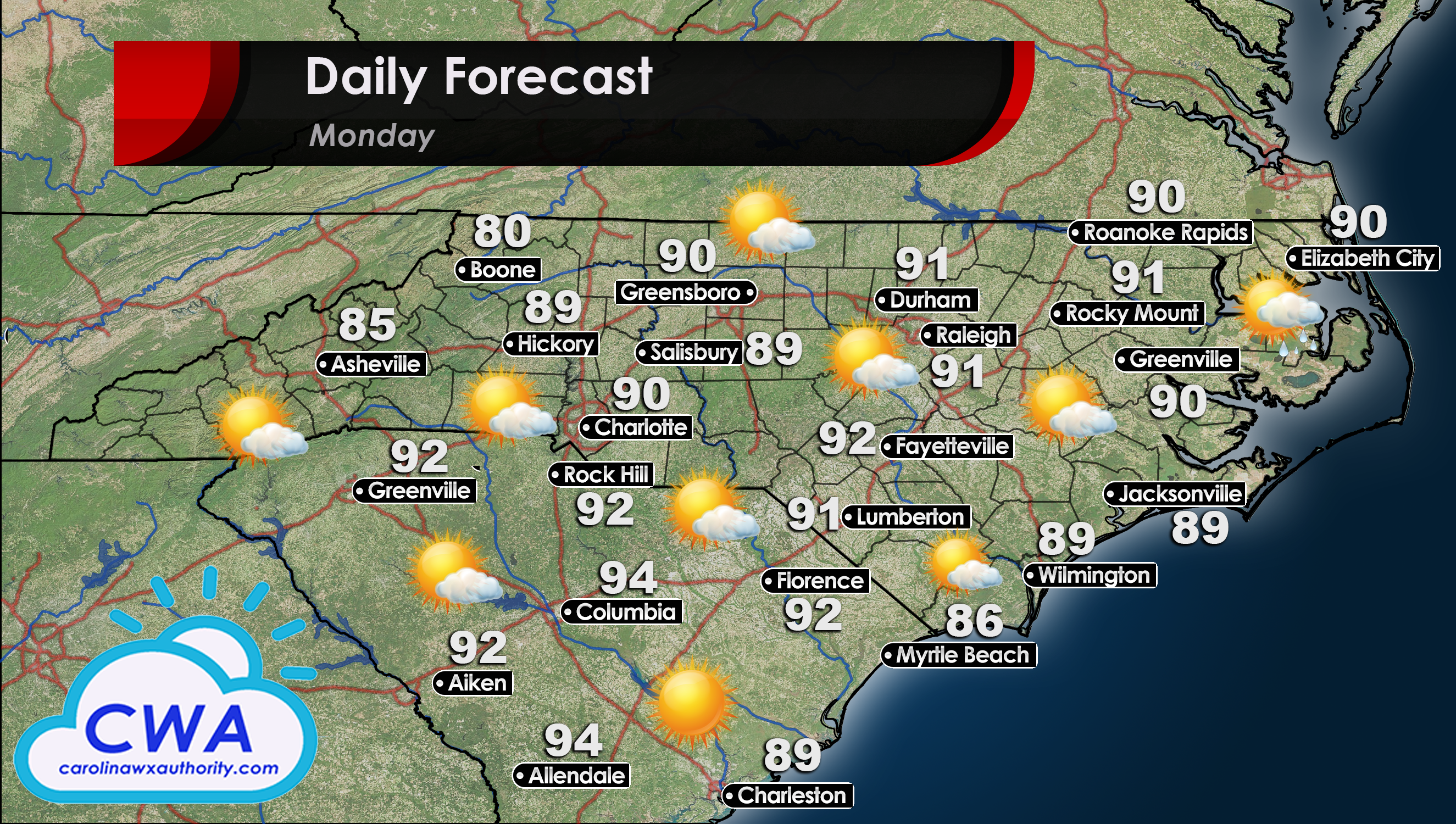
Magnificent Monday on Tap
Across all of North Carolina and South Carolina, the start of the work week is looking gorgeous! While high temperatures will be low 90s in the North to mid 90s in the South, the dew points will be relatively low. This should keep humidity in the 60% to 70% range for most locations. The beaches will be a few degrees cooler and the rain we saw over the weekend should stay away for Monday. If you want to squeeze in one extra day at the beach, I would highly recommend it.
For Central NC and SC, we certainly can’t rule out a storm here or there with daytime heating, but the activity should be very wide spread. The best chances for rain will be in northeast North Carolina in spots such as Elizabeth City, Rocky Mount, and Greenville. Even in these locations though, I am not expecting any widespread shower/thunderstorm activity. Enjoy the weather while you can, as Meteorologist Mike Griffith has warned us that some much warmer weather is on the horizon!
You must be logged in to post a comment.