

We won’t be looking at a major tropical system this weekend, however the next name on the list is Wanda. This disturbance could have more of a nor’easter feel to it, since the system will be born off the Carolina coast. This will bring some 35-45 mph winds with higher gusts possible to the Outer Banks.
Currently this system has a 40% chance of formation, therefore this system will likely just be a rainmaker, but could kick up the seas a bit also.
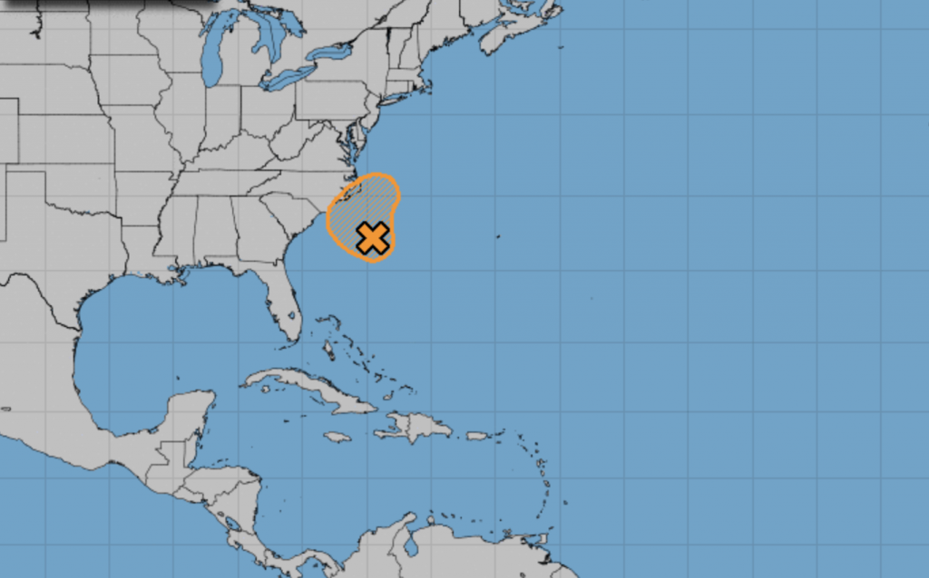
If this system does get a name, Wanda is next on the list. In all likelihood, this will just be a swirl offshore that makes a lot of rain inland.
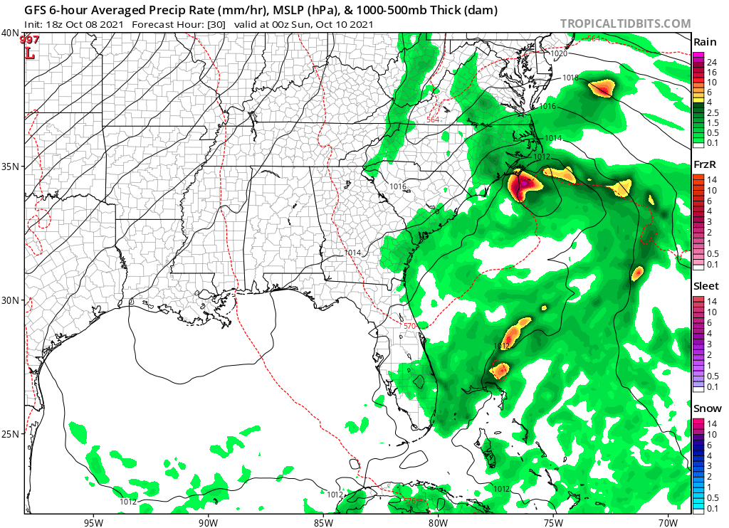
Below is the GFS for tomorrow evening. This system does not appear to be impressive at all. The Outer Banks will be the location most impacted. Eastern NC could see more rain Saturday from this system.
Pay attention to local NWS offices warnings watches and advisories. Also be aware of rip currents.
You must be logged in to post a comment.