
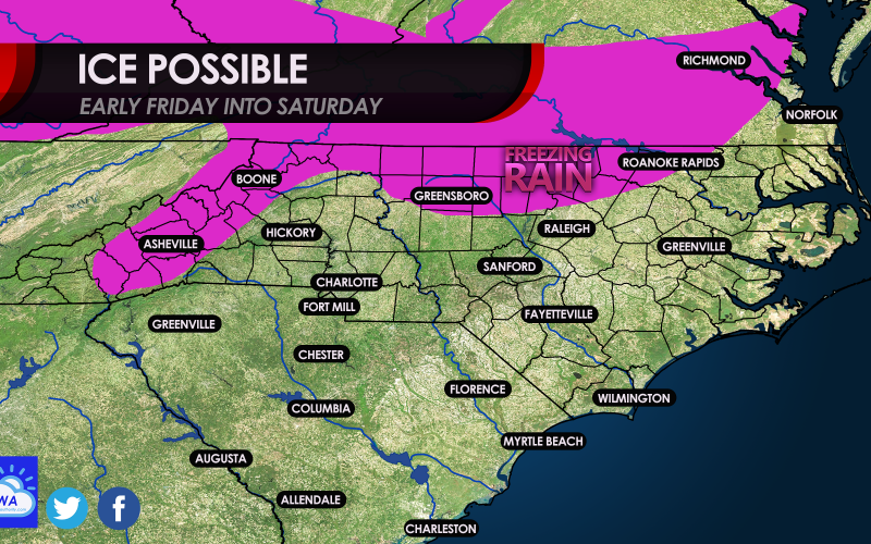
As a storms system moves in late-week, a potential long-duration light icing event is possible for parts of the northern NC and the NC mountains. This ice threat also extends into Virginia. We actually believe this bears watching, since ice events are usually slow and light, and last long. That means if the drizzle or rain is very light, and it’s quiet outside and cold, that ice could start to build on on surfaces. Of course, physical surfaces have to be either 32 F or below for the rain or drizzle to freeze on contact. These events are extremely tricky to predict even 24 hours in advance.
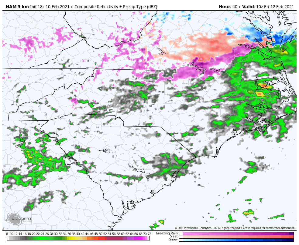
However, starting in the early am on Friday, light freezing drizzle could spread across northern NC, between 4 and 7 am. Below is what the radar could look like early am Friday.
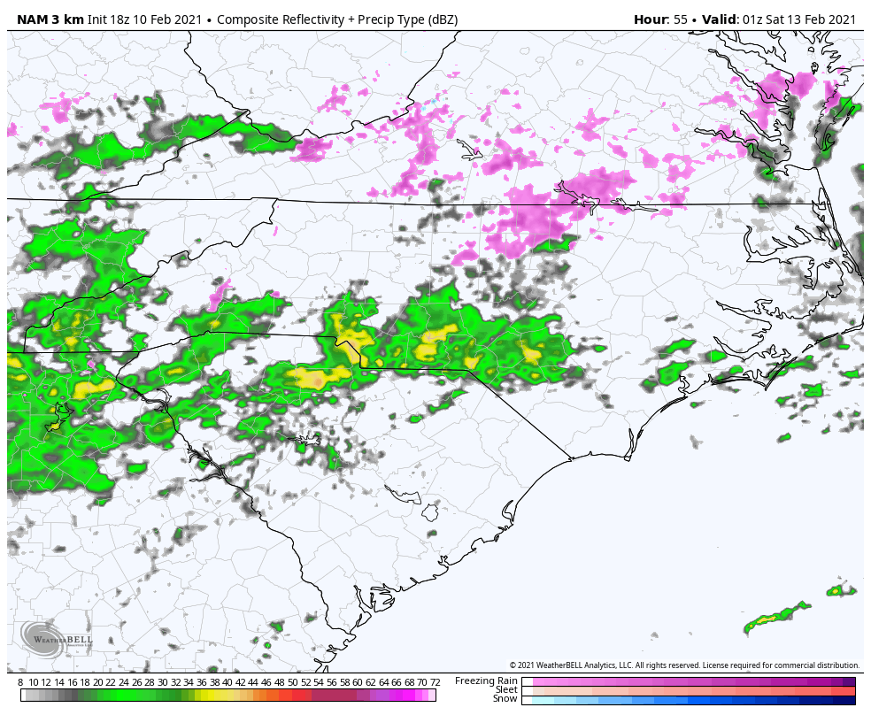
By Friday night, the radar still has light freezing rain across northern NC and southern VA, and this look is concerning because it is light. This is usually an accurate indicator of and icing event that is underway. Below is the futurecast radar for around 8 pm Friday night.
Overall, the total swath of freezing rain could extend from the NC mountains and across northern NC and southern VA. The icing may extend into parts of eastern VA including the Tidewater.

Stay tuned for updates here on the site and also the Facebook page! Please share this article if you liked it!
You must be logged in to post a comment.