
REST OF JULY WILL NOT BE TOO HOT
This may be the weather’s making up for an early start to summer back in May, and the scorching heat in June. As of now, we are not in a heatwave and we will not be for the foreseeable future. This does not appear to be a transient pattern, since the summer chill will persist into early August.
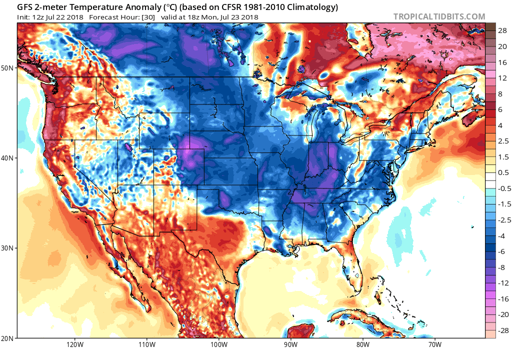
The below normal pattern takes shape this Monday, as our powerful Northeast storm will wrap in cooler air behind. Much of the Eastern US will experience more of a mid-August airmass.
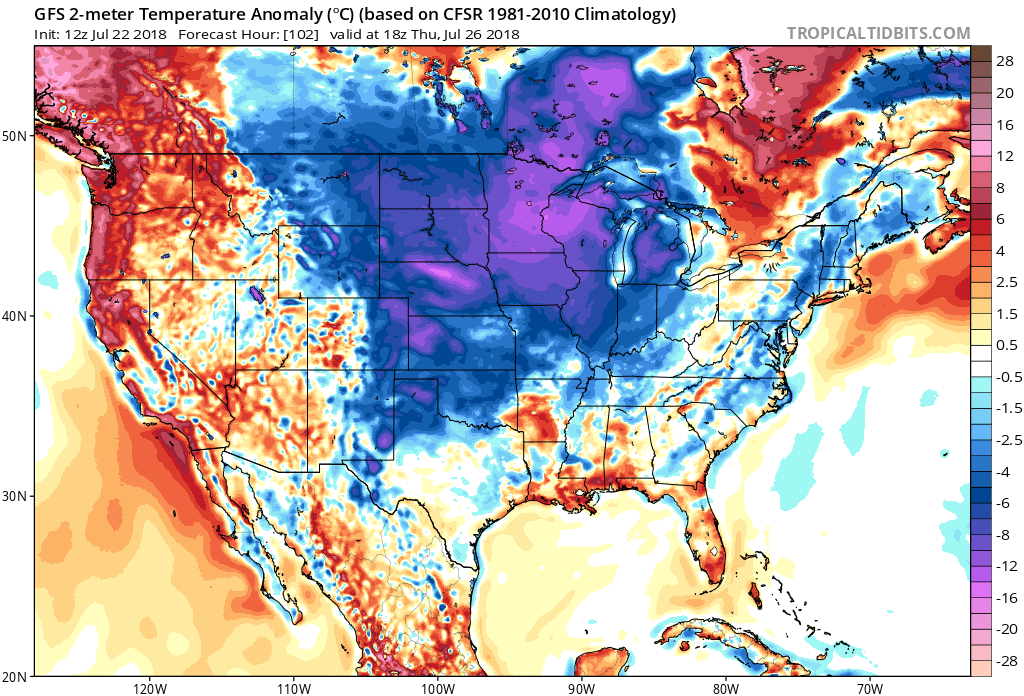
Repeated shots of cool air could cause some record lows in the Plains, however we shall see if that’s the case. I’m hedging my bets though, since this is usually the hottest time of year for many. The source of our cooler air outbreaks will come from the Plains. GFS for the 26th:
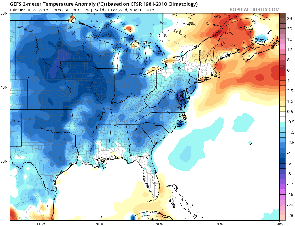
NOAA CPC is also seeing this trend, and is saying we will be below normal from the 29th to the 4th. This will save on many a/c bills and energy usage!

Please share this article with your friends and family using the button below! Also check out our latest blog on https://carolinawxauthority.com
You must be logged in to post a comment.