
3-12-2017
Mike Griffith, Meteorologist
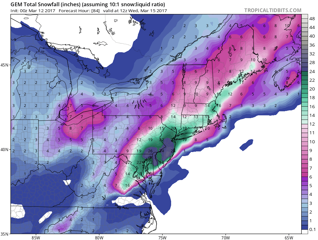
There is an ongoing debate between us Americans and the Canadians. They think that the hammer now drops over Philly and NJ. Keep in mind this INCLUDES SLEET, therefore some amounts could be grossly overdone.
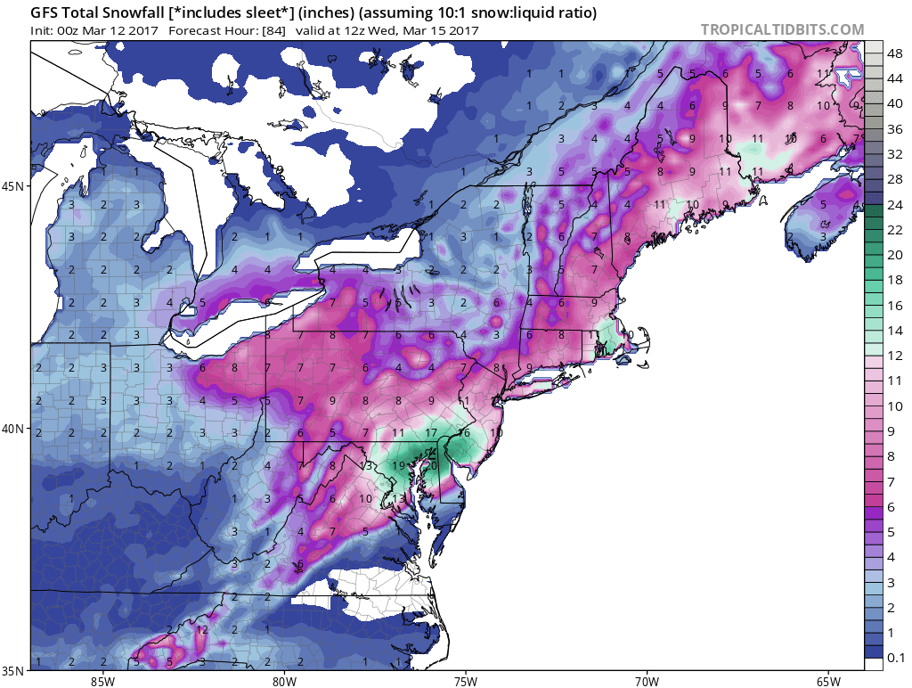
First up is the CMC, which is CRIPPLING. Second image to the right is the GFS, with not as much frozen precipitation amounts. This is not necessarily all snow.
Click any image for larger version.
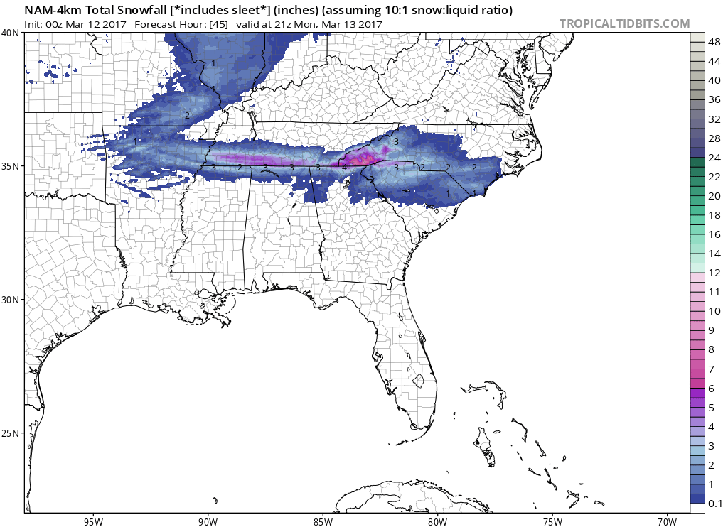
Watching a little snowstorm in the South tonight, a “Southern Slider” only affecting the South with perhaps an inch of snow.
What’s the euro say the euro predicted this back on February 24. As I posted it on my Facebook page