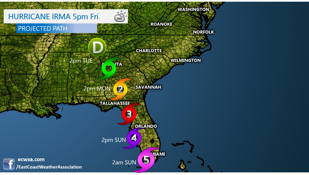
Extremely dangerous Hurricane Irma is in the Caribbean currently wreaking havoc with Cuba, and then will make a northward turn Saturday into Sunday. The forecast path is now to the west of Miami, however they will still feel very dangerous effects, such as 110+ mph winds, flooding, and tornadoes. The storm is then expected the gradually weaken as it moves north across the Florida peninsula into early next week. It is then expected to stall out somewhere over eastern TN. For the Carolinas and farther north, this will basically be a wind and rain event, but enough to cause scattered power outages. However, we will NOT experience what Florida will.
Latest Forecast Track and Arrival Times of Irma


You must be logged in to post a comment.