
FLORIDA COULD BE IN CROSSHAIRS FOR DORIAN
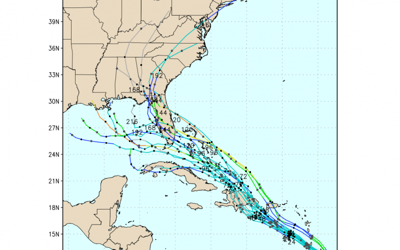
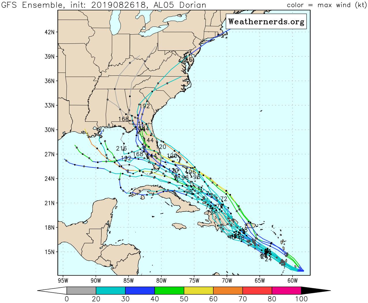
The latest GEFS ensembles track Dorian into Florida with pretty good agreement, and there is also good agreement for it being a tropical storm strength-wise. Currently the storm will be affecting the Windward Islands including Barbados, and will move near Puerto Rico and Hispaniola afterward. The question is can Dorian overcome the mountainous terrain of the Dominican Republic, and also can it survive a hostile environment that it will move into?
At any rate, Florida looks to be the recipient of Tropical Storm or Tropical Depression Dorian over the next 7 days or so.
Latest GEFS ensemble tracks:
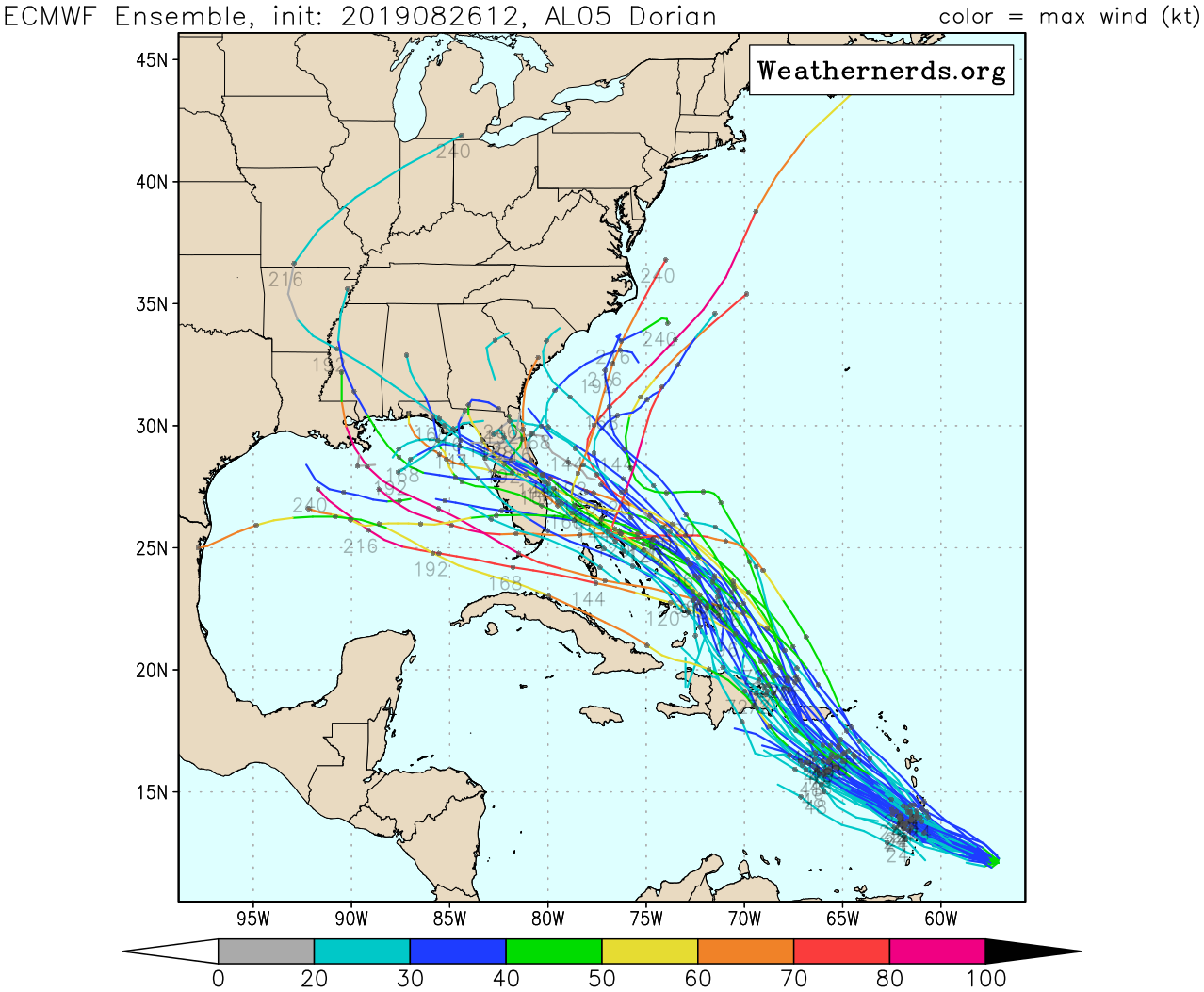
The latest Euro ensemble tracks are all over the place and resemble a bowl of spaghetti. Anywhere from the Carolinas to the Gulf Coast is in play according to this model. The median or average track is still into Florida.
Everyone from Florida to North Carolina needs to monitor this storm, and consult your local NWS office for official info. Images were taken from weathernerds.org, so if you love weather models, give that site a visit!
-Mike G.
CWA
You must be logged in to post a comment.