
HARVEY TO THREATEN TEXAS COAST, LOUISIANA
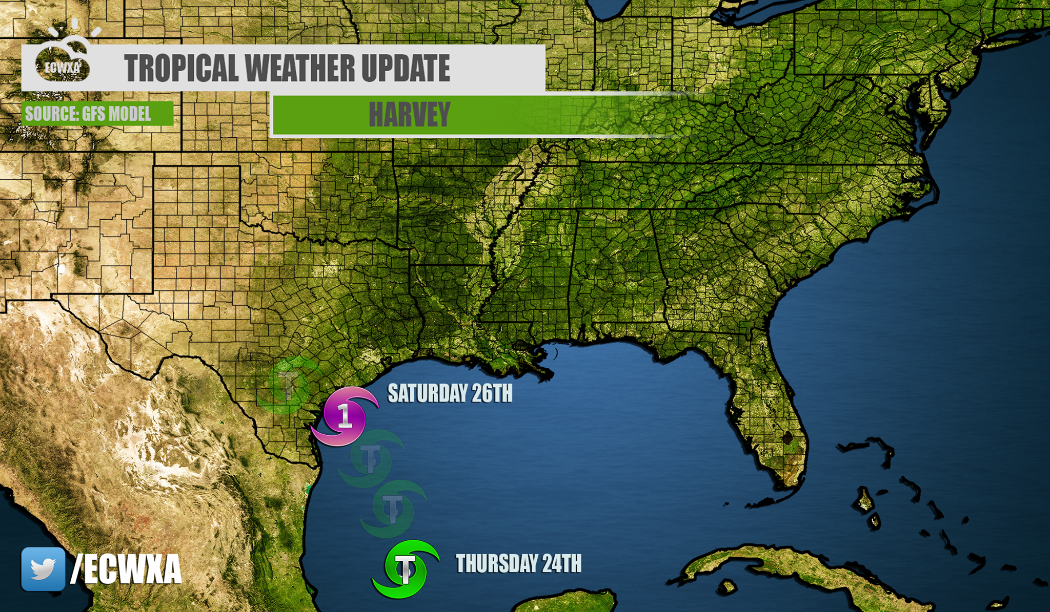
The GFS model has been fairly consistent with a landfall somewhere along the Texas Coast. The GEFS ensembles have been quite a mess, and have a landfalling tropical system anywhere between Corpus Christi and Houston. However, the single deterministic GFS is indicating a hit somewhere between these two cities.
GFS:
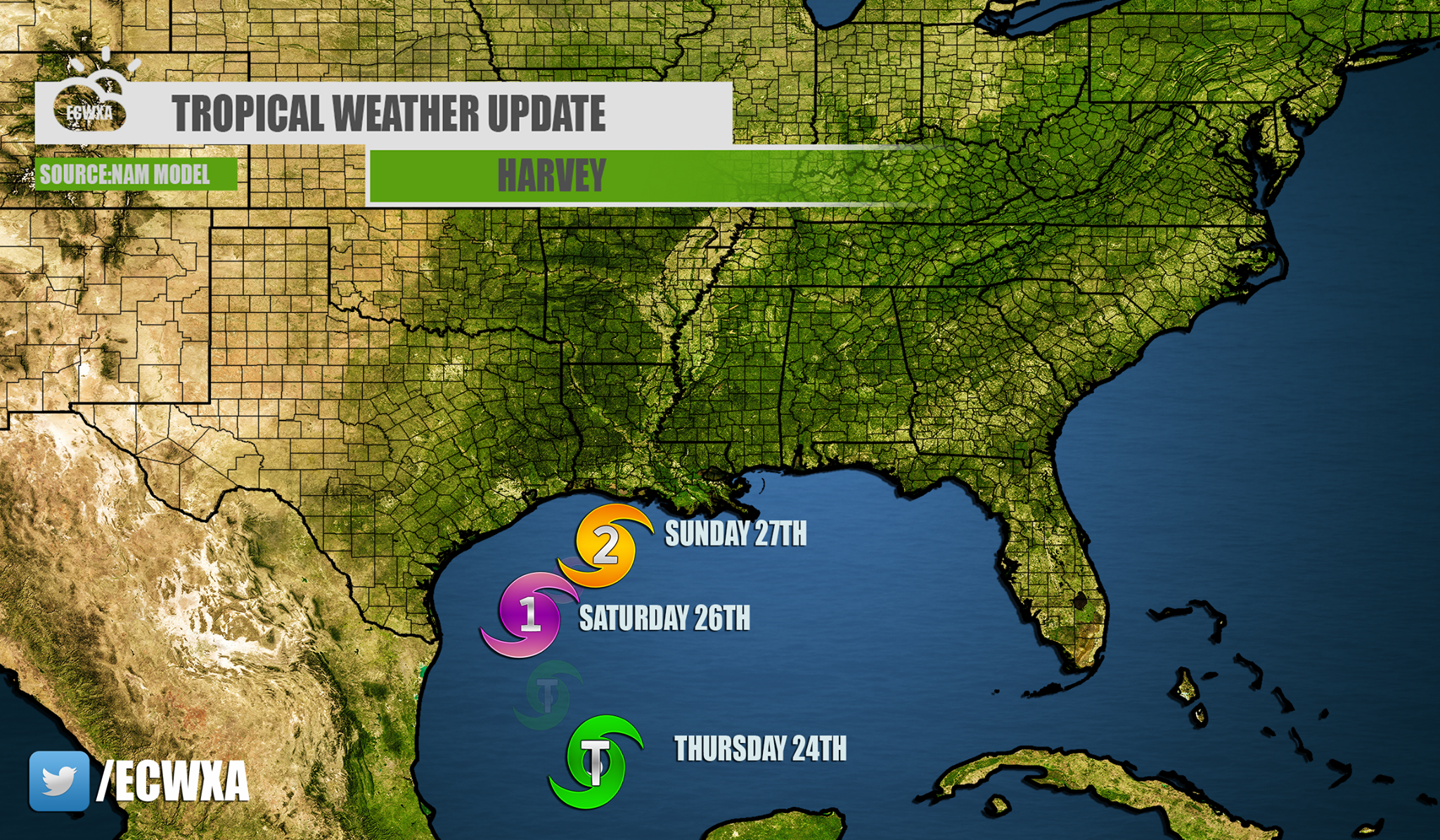
Now the NAM, since it is higher resolution, has the storm taking a right turn after it hits Texas, if it even does. That means that Louisiana would also be impacted by this storm. If this is the case, and Harvey does not make landfall in Texas, then it would strengthen into a Category 2 hurricane before making landfall somewhere in Louisiana.
NAM:
Obviously the Gulf coast from Texas to New Orleans should be on alert for this storm. It will bring a TON of rain, REGARDLESS of strength. If it is a tropical storm or hurricane, it will bring catastrophic flooding somewhere between Texas and Louisiana. This is also true for any towns or cities inland. This danger will not be limited to just the coast.
You may comment or ask questions below, as long as it’s classy. Thanks!
You must be logged in to post a comment.