

Hello members,
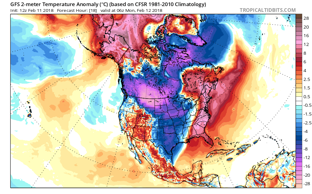
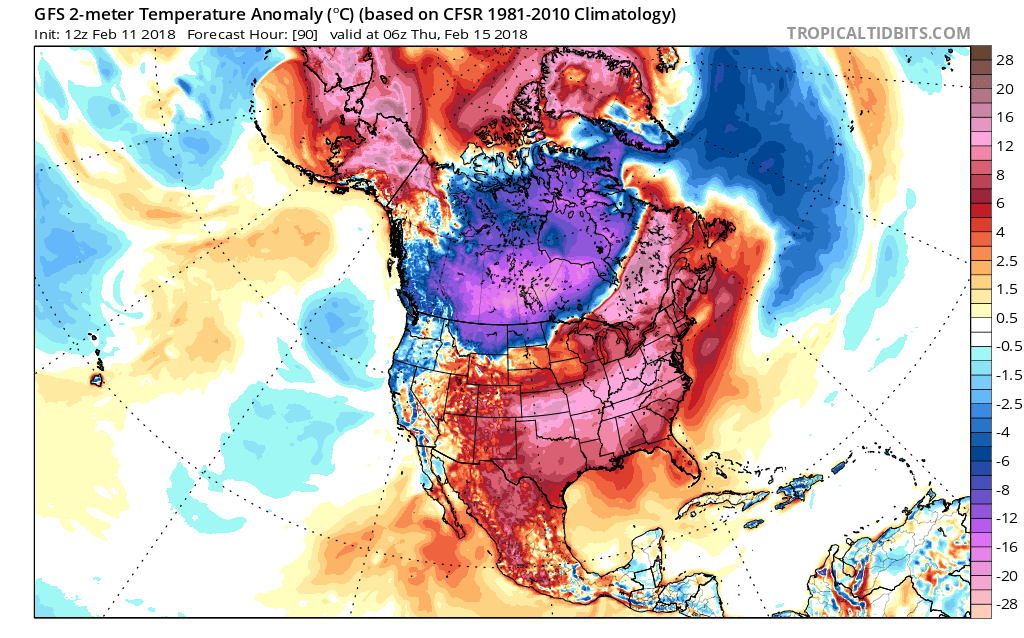
By now you probably might be confused on if it’s going to get cold again, or if we are going to get any more snow. All I can say is that the warm is going to hang around, and won’t be going anywhere for a while. This is the most likely story, at least for the Southeast. A powerful upper-level ridge of high pressure will take shape over the Gulf, and will pump up our high temperatures into the low 70s in spots! First image is temperatures departures from average for Monday. Second image is Wednesday into Thursday. Expect to spend some of Valentine’s Day outdoors since it will certainly be nice enough. Of course if it’s not raining in your neighborhood.
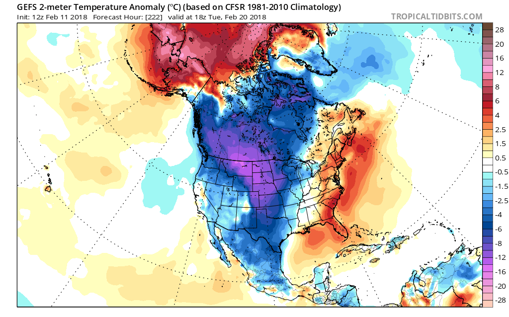
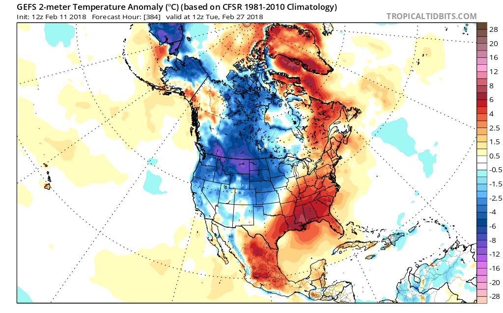
Remember that stratospheric warming we were talking about? It will happen, but it will cause a piece of the Polar Vortex to split and send the cold over the West Coast. In turn, this will push up a ridge in the East, and will cause our temperatures to soar for this time of year. Shown in the GEFS ensembles below, we can see how the cold will spill into the West. We will likely see mudslides in California, as well as flash flooding out west and mountain snows. You will likely hear this in the news in the coming days and over the next couple of weeks. GEFS ensemble image is valid for February 20th. The warm wants to hang tough in the East. This remains the case through the end of this month! Second image is valid for the 27th.
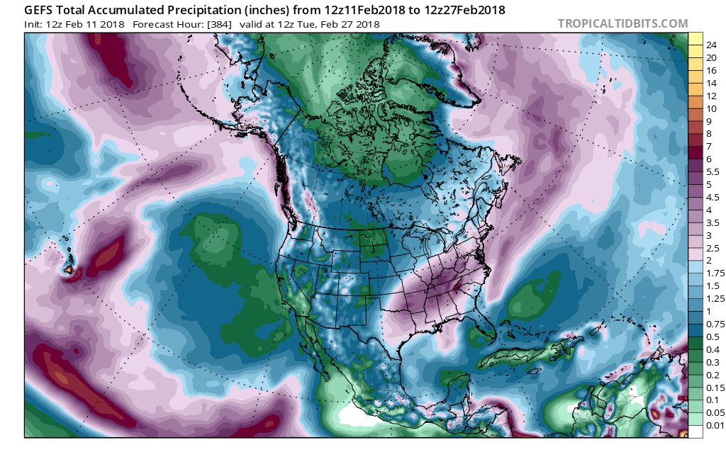
How about precipitation? Will it be wet or dry? Through the end of this month, the GEFS ensembles are indicating a very wet pattern. for the Southeast. This is likely due to the wind and circulating pattern around a ridge of high pressure. Since the winds turn clockwise with a High, it will be bringing tropical moisture up from the Gulf. Not only does this keep us warmer than average, but also wetter. Plan for a lot of rain! Beach days may not be all that spectacular. Also plan for ponding in backyards and flooding. GEFS total accumulated precip through the 27th is shown.
We are NOT going to say winter is over, because it’s anyone’s game in March. But the farther South you are, your chances decrease dramatically for any type of snow or ice. Not only does the sun angle start to increase and the days get longer, but things warm up in the South rapidly. Our last hurrah will be in the first week of March, if we can get one.
Thanks for staying in the loop, behind the scenes! It would be nice if you could refer some of your friends to this membership! If you send enough subscribers our way, we may just eliminate your fee.
Thanks,
Mike
You must be logged in to post a comment.