
This Memorial Day Weekend across the Southeast we are looking at the first named storm of the 2018 Atlantic Hurricane season to make landfall somewhere between the Florida panhandle and Louisiana.
Invest 90L has quickly organized and is expected to be named Alberto within the next 5 days.
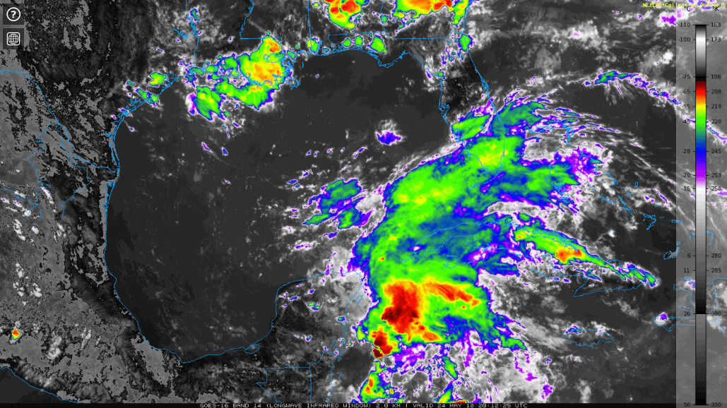
GOES 16 Long-wave IR Imagery as of 00z:
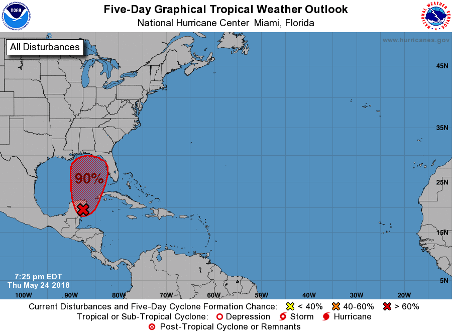
The National Hurricane Center is now expecting this to develop into a tropical storm as they increased the probability to 70% over the next 48 hours and 90% over the next 5 days.
NHC 5 Day Graphical Outlook:
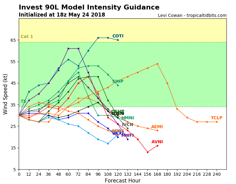
Models now have this system strengthening into a tropical storm with winds greater than 35 knots.
Tropical Spaghetti Plots:
(Intensity)
(Tracks)
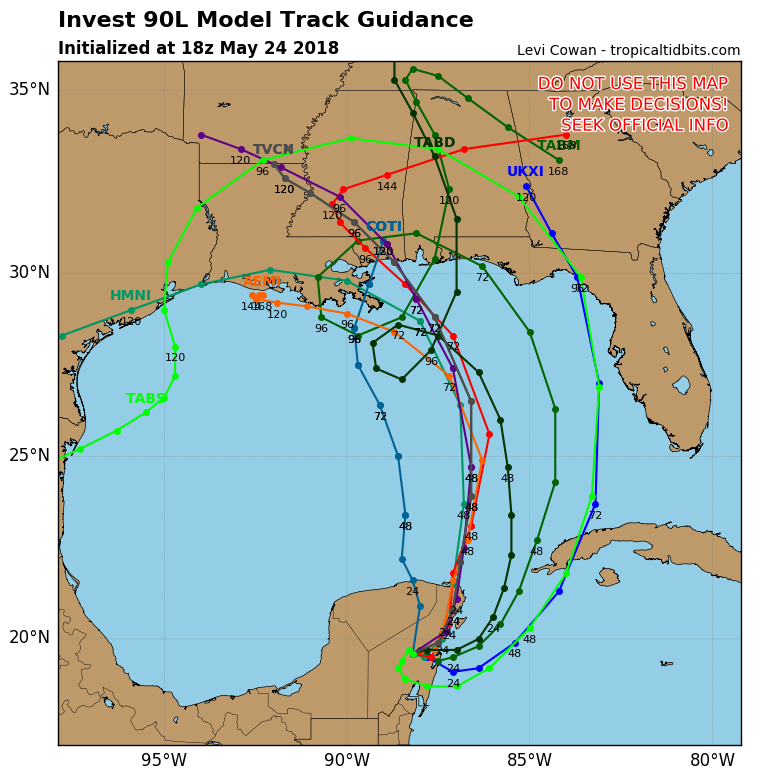
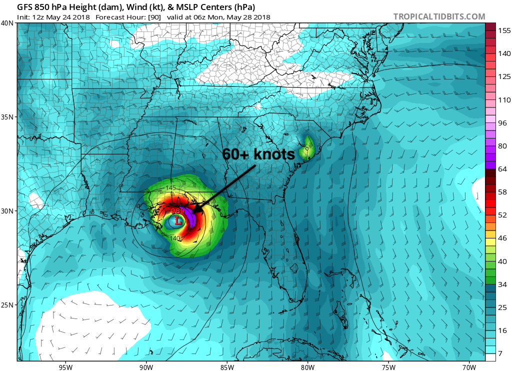
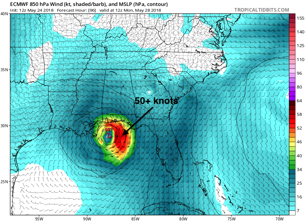
This storm is destined to make landfall in the US, but intensity is still to be determined. 12z GFS and Euro have this storm becoming a strong tropical storm with hurricane force gusts likely.
GFS 850 Wind and MSLP for MON May 28th, 2018:
Euro 850 Wind and MSLP for MON May 28th, 2018:
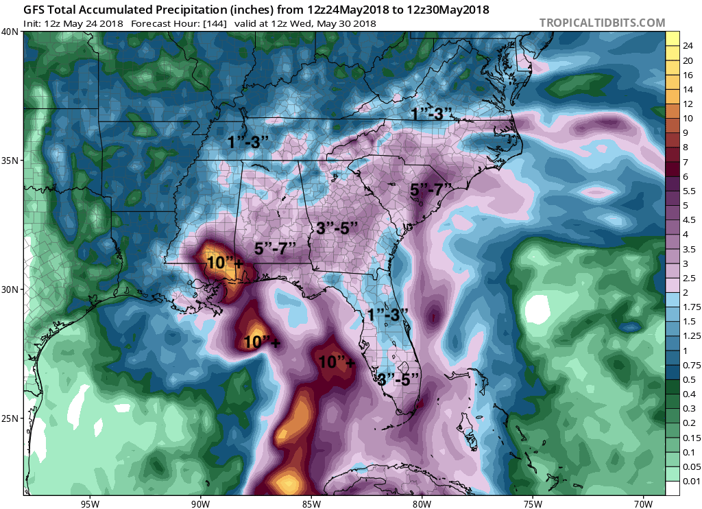
Another aspect of this system as it washes out many peoples Memorial Day plans is the heavy rain. Some places could see upwards to a foot of rain which will cause major flooding to already drenched areas in the Southeast.
GFS Total Accumulated Precipitation Until WED May 30th, 2018:
Make sure you stay with us here at East Coast Weather Authority as we update you on this ongoing situation.
-Alex B
You must be logged in to post a comment.