
Warm and wet week is in store for this week across the Eastern US, but does this signal the end of winter? Upper air analysis says not so fast, with the possibility of an upcoming blocking high which would trap cold air for the Eastern part of the US.
GEFS ensembles are showing an intense ridge that will start to build over Greenland by the end of February and peak at full strength by the beginning of March. Now, why is this important and how does this play a role in our weather? Well, if a ridge builds over Greenland it will help keep the colder air into places along the East coast including the Southeast, and allow storms to dig deeper to give us one last shot a some snow.
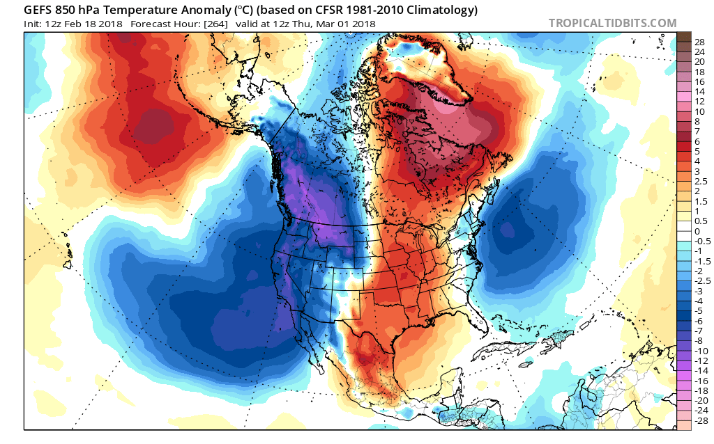
GEFS 850hPa temperature March 1st:

Notice how a ridge is building over Greenland by the end of February, and the cold air below it. This ridge looks to be persistent which would then allow cold air to build in the East especially along the East coast as far south as Florida.

The pattern is always changing, but the idea of a beginning of March cool down is growing in confidence, enjoy the warmth this week, and continue to watch this evolution with us!
-Alex B