
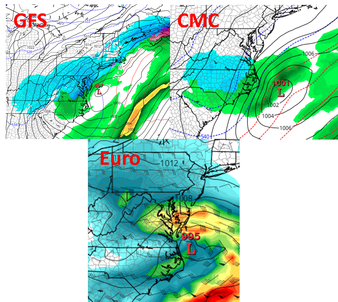
MORE SNOW?
Here it comes, another Nor’easter or “Four’easter” as we have said, since this one would be a four-pack if the forecast verifies. We are looking at Tuesday or Wednesday of next week. It is not yet clear as to who gets how much snow, or the track of the low, but that someone will get snow.
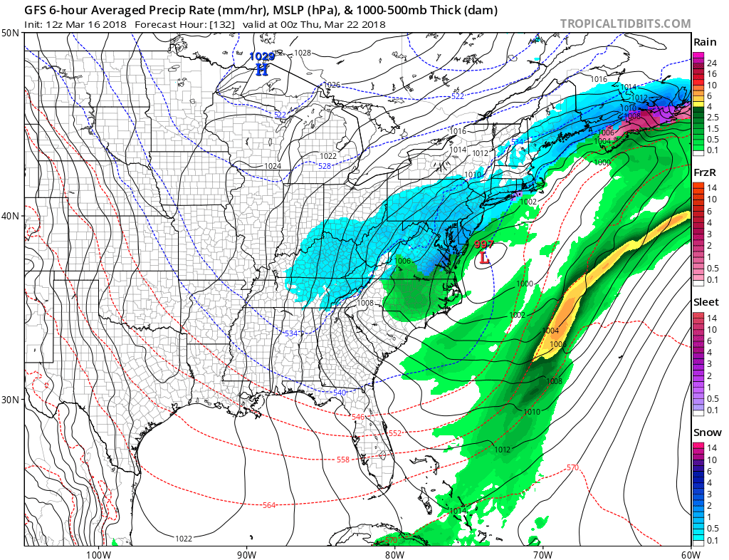
The three major forecast models are agreeing that something will be lining up next week, as another coastal low takes shape off the NC/VA coast. The latest GFS, taken verbatim, would mean snow for DC and much of Virginia. Also, the I-95 corridor would receive snow from Baltimore to NYC.
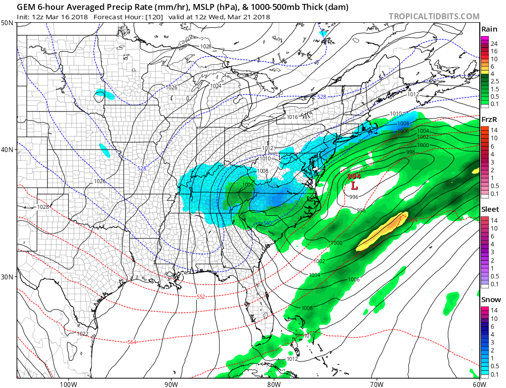
The Canadian model is now starting to come in line with snow down into NC on Wednesday, or Tuesday night into Wednesday.
Hang on, since winter is not over yet! Member’s emails are being sent out, so make sure you join the action since you may miss these updates on social media, as they are not always in your feed.
Sign up here if interested >>> https://carolinawxauthority.com/subscription-options
-Mike G
East Coast Weather Authority
You must be logged in to post a comment.