

5-9-2017
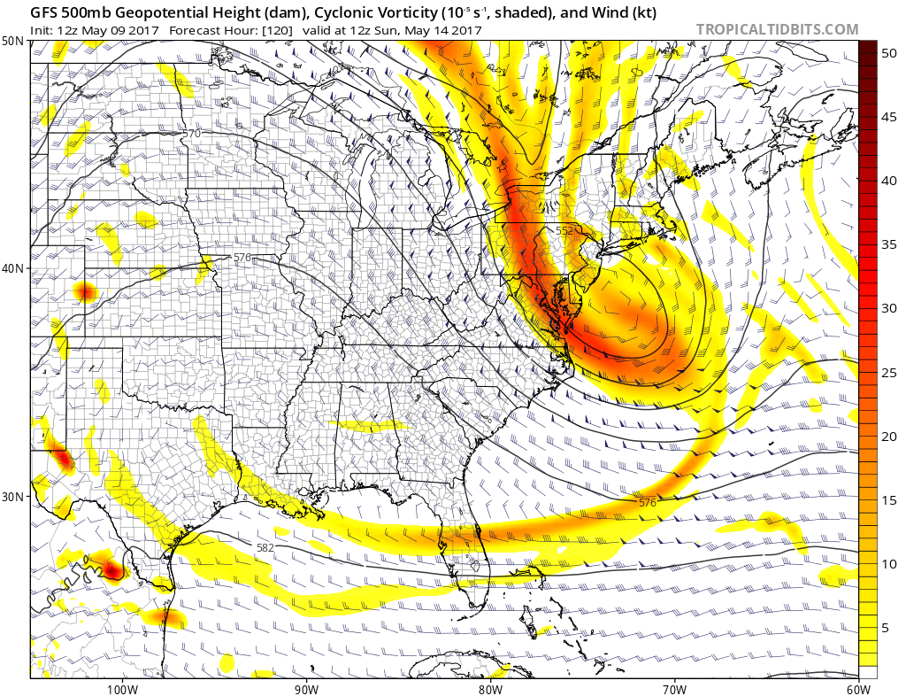
The GFS model phases two pieces of energy this weekend just off the Virginia coast, and causes a big storm to emerge. This was at first on Saturday the 13th with this model, but now the ingredients are coming together on the 14th (Mother’s Day). The GFS shows the upper-level energy merging and also the precipitation output valid Sunday morning:
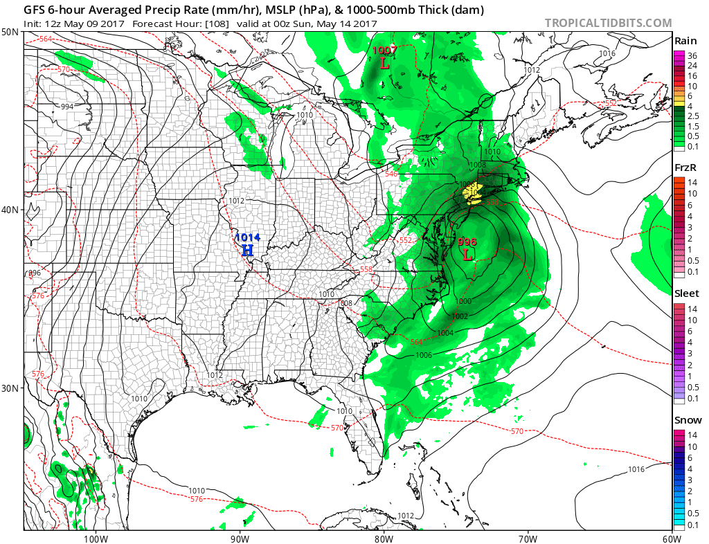
However the GFS model is not an outlier. Here is the European showing the same storm system, and also has a VERY strong nor’easter moving into New England.


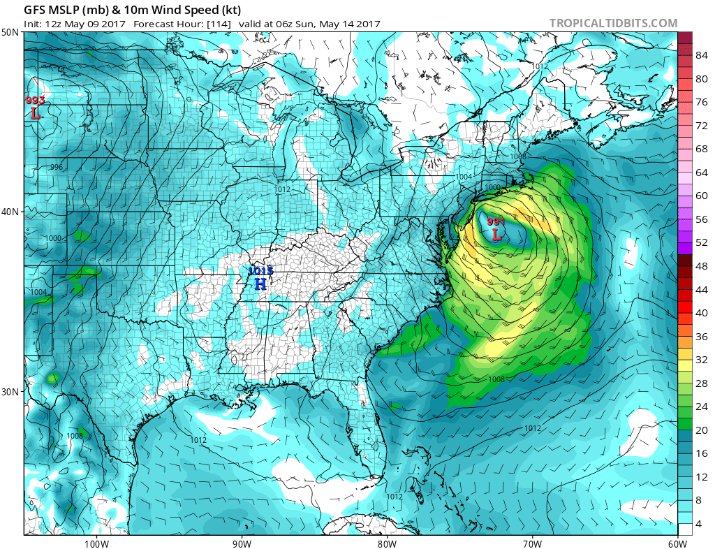
Not only will the rain be very heavy, especially along the coast, but the winds will also be very strong and gusty, especially along the coast. Winds will be gusty all the way from South Carolina to Massachusetts. The strongest winds will be from Cape Hatteras the Jersey Coast, but will also extend into New England. We’re also looking at gusts up to 50mph but we will continue to monitor to see how bad of a storm this will be. GFS 10 meter winds:
Mike Griffith, Meteorologist
East Coast Weather Associaton/Carolina Weather Pro
Like Carolina Weather Pro on Facebook if you live in NC or SC: https://www.facebook.com/carolinaweatherpro
Subscribe to our Youtube channel! https://www.youtube.com/mjggriff