
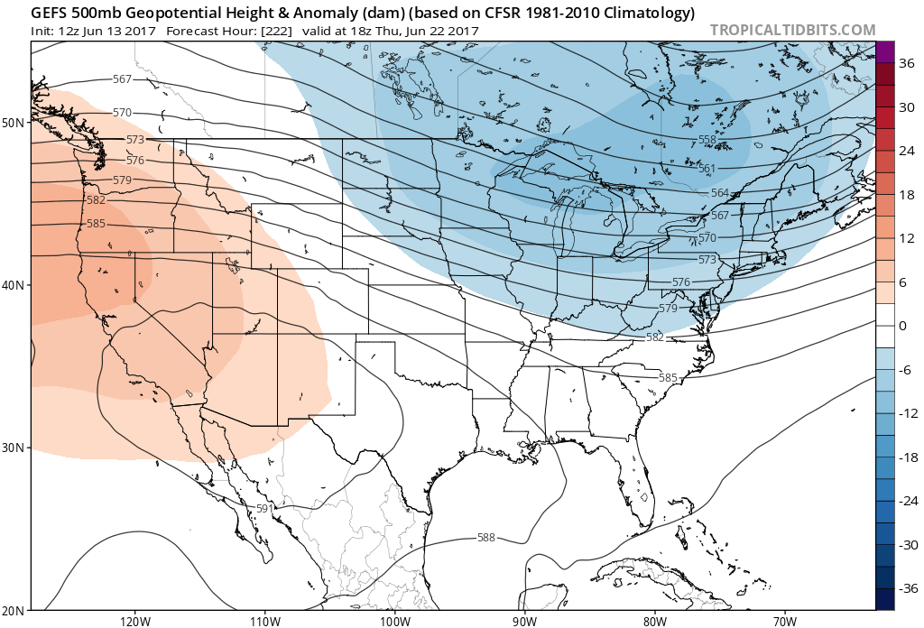
Don’t like the heat? Well there is good news for you, since it will not last. We are looking at the GEFS ensembles, and they are showing below normal temperatures for later this month. The blue is a trough in the East and thus chilly air. This could come at a price with severe thunderstorms first to break the heat. Then we will be cool and stormy. A significant upper-level ridge will build out West, bringing very hot conditions there. This will be the trend in the coming weeks.
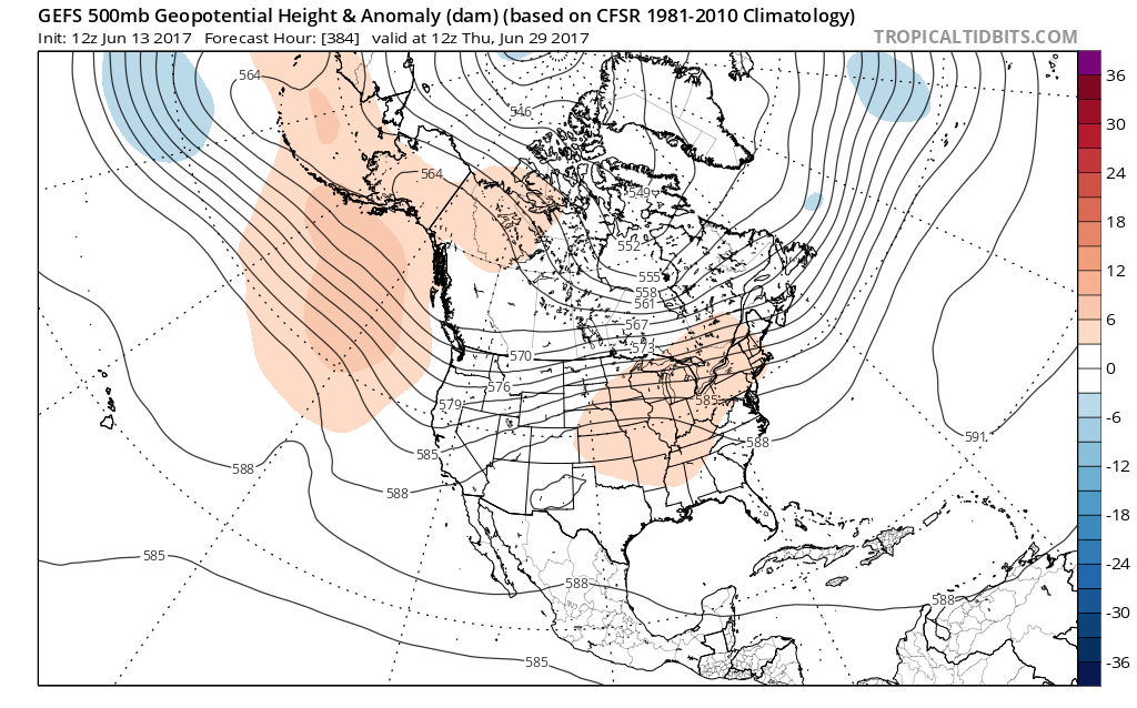
To end the month of June, we could be looking at a shift to an upper-ridge in the East, which would mean above-normal temperatures. This ridge at this point does not look impressive, so it’s hard to tell how significant the ridge will be. It could be a temporary ridge that will break down quickly with more showers and storms to start July.
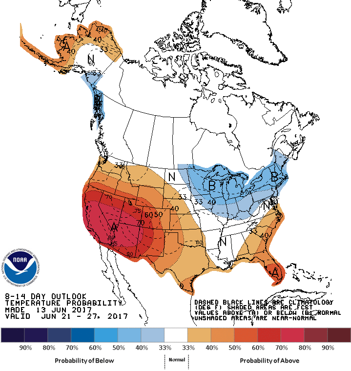
Here is the outlook from the Climate Prediction Center from June 21-27. They are going with below normal in the Northeast (I agree) but above normal in the Southeast ( I disagree). Those are my thoughts on temperature trends to end this month.
Be sure to like Carolina Weather Pro on Facebook
You must be logged in to post a comment.