
The NHC has now increased their probability to 50% of formation with the tropical wave currently in the Atlantic. This wave is forecast to continue it’s westward journey across the Atlantic. The question is, what will it do when it gets closer to land?

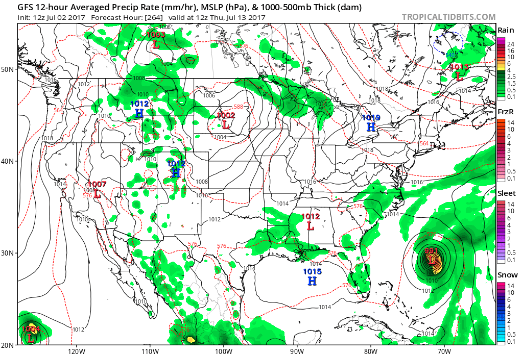
The operational GFS model has the tropical system as a tropical storms off the coast around the 10th of this month. It then has the storm taking a northward turn away from land. Let’s hope this is the case.
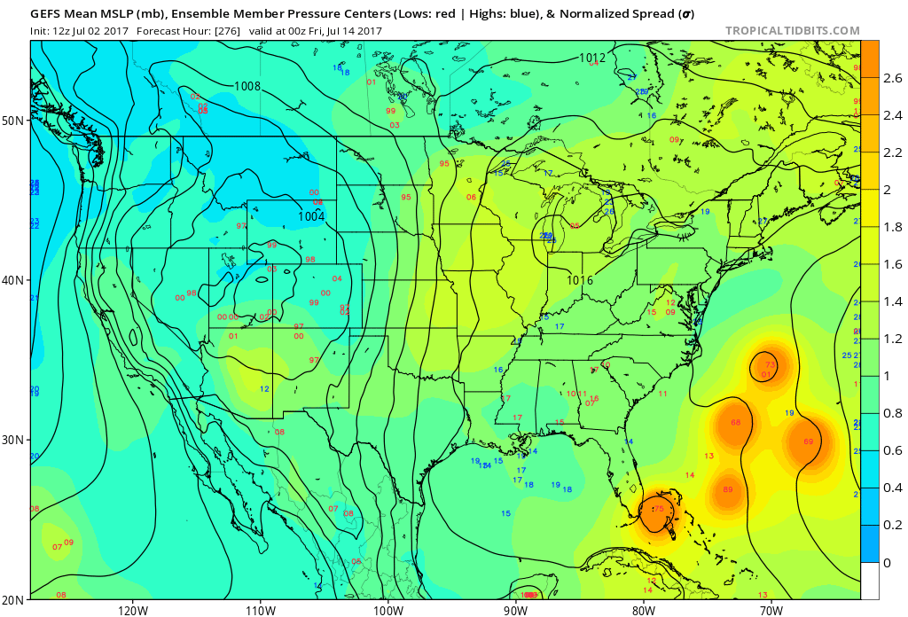
However, the cause for concern is the GEFS ensembles, have different areas of low pressure. This means that any of these areas of low pressure could be the center of this tropical system. The GEFS has a split in the tracks, one of which would be a direct hit on Miami. It all depends on what the high pressure system over the Atlantic does. If it moves west, look out. If it drifts east, then the storm will likely head out to sea.
Most of the ensemble solutions have it with the northward turn out to sea, so that’s good!
For subscriptions to our forecasts and alerts: https://carolinawxauthority.com/membership-options
Sign up for our subscription services to follow more closely: https://carolinawxauthority.com/subscription-options
You must be logged in to post a comment.