
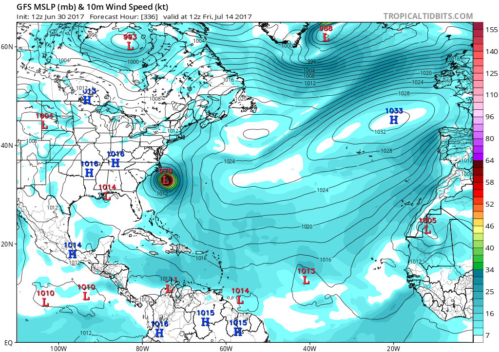
Hurricane season is in full swing, and you should have a plan of action should the need arise. We are looking at the GFS, which has some kind of tropical system off the Carolina coast between July 10-13th. The strength is not well known at this time. The first image is from the operational GFS, and shows a tropical system looming just off the East Coast. There is the chance that the system will take a northward turn, and will not affect land, other than perhaps Bermuda.
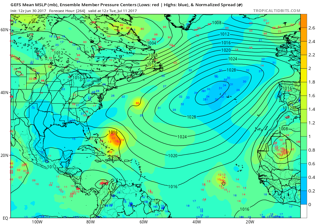
The second image is the GEFS ensembles. The yellow area is a cluster of possible centers of low pressure, and thus the possible locations of where the tropical system could be. This is anytime between the 10th and 13th of July. We will have to watch this, as a path into the Gulf, or a path up the East Coast is possible. The GEFS has the storm either go into the Gulf, or take a northward turn. However, this might be too close for comfort. Stay tuned as we will update this developing situation.
To get updates and more personalized forecasts, sign up at https://carolinawxauthority.com/membership-options
You must be logged in to post a comment.