
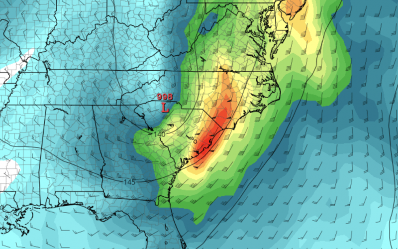
Effects from Hurricane Nicole could start to be felt here in the Carolinas as early as Thursday, as winds will pick up due to a tight pressure gradient between the hurricane and high pressure to our north. As a result, windy conditions will prevail between Thursday and Friday when the storm exits.

Be sure to clear away any leaves and debris from storm drains, as they will contribute to street flooding if they are clogged. Heavy rains will cause some areas to flood and could create dangerous driving conditions. Turn around, don’t drown.
Power outages with 40 mph gusty winds are possible, but will be scattered. Still, charge up those phones and electronic devices.
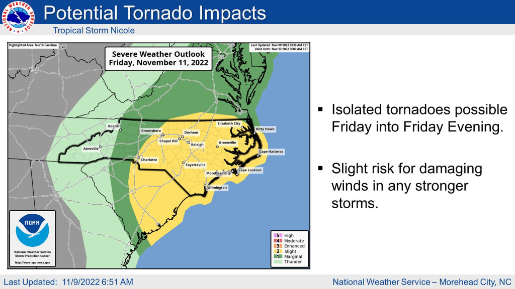
The other threat will be tornadoes as Jesse mentioned on the page. This threat, along with the other threats will be on Friday. Landfalling tropical systems typically produce tornadoes on their right side, and for Nicole this will be the eastern Carolinas all the way to the coast. Have a way to receive timely alerts from the NWS.
Nicole will be a tropical storm when she arrives. We are not expecting widespread damaging impacts, however it does not take much with a tropical system. Stay tuned to your local NWS office for all official safety info.
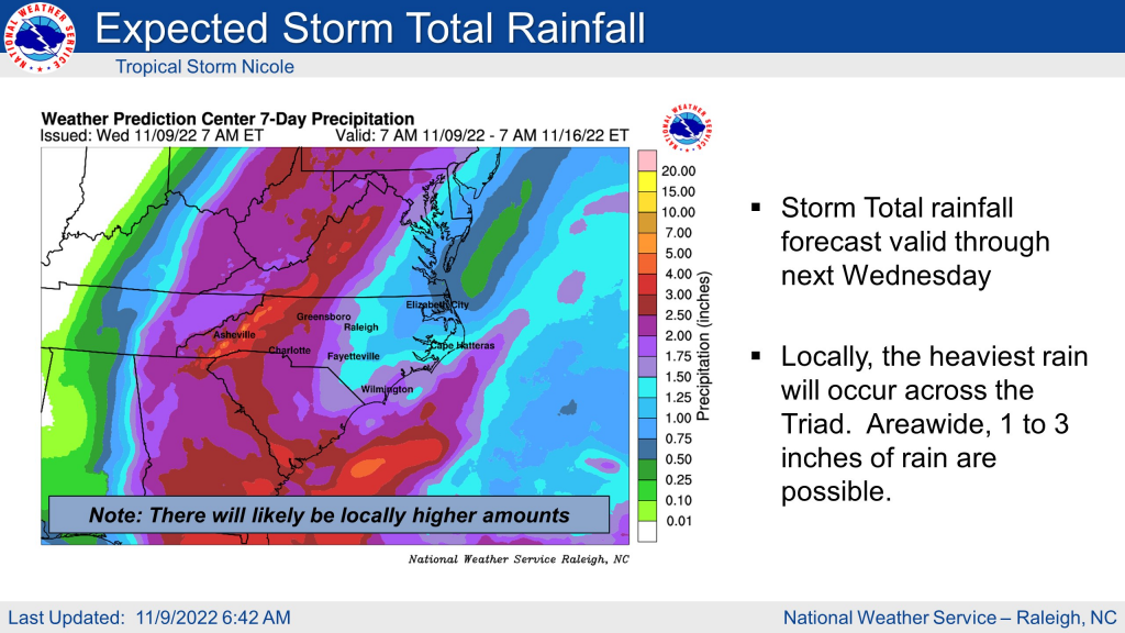
Overall Friday will not be a pleasant day to be out due to wind and rain. Travel is not recommended, as it will be a good day to stay inside. Below are the expected rain totals (estimate):
Stay safe and follow your local NWS office and the news for all info on Nicole!
You must be logged in to post a comment.