
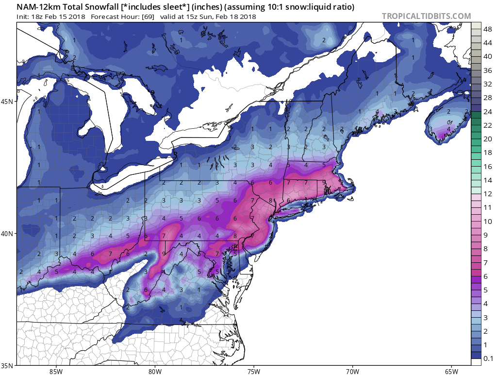
The NAM is now within range for some more hi-resolution forecasts. One thing to keep in mind, is that these totals take sleet into consideration. Plus, the ground is already warm due to the recent warmth we have been experiencing. Therefore, these totals may have to be cut in half.
Nam snow totals ending 10am Sunday:
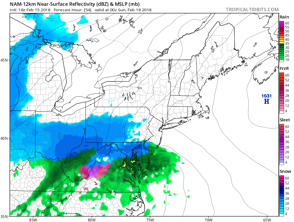
Start time is most likely after 7pm Saturday. DC will be first on the list to receive wintry precip including sleet. Nam shown for 7pm Saturday:
Philly will be borderline rain/snow through the event, but a better bet for snow/sleet is in the northwest suburbs. Nam shown for 4am Sunday: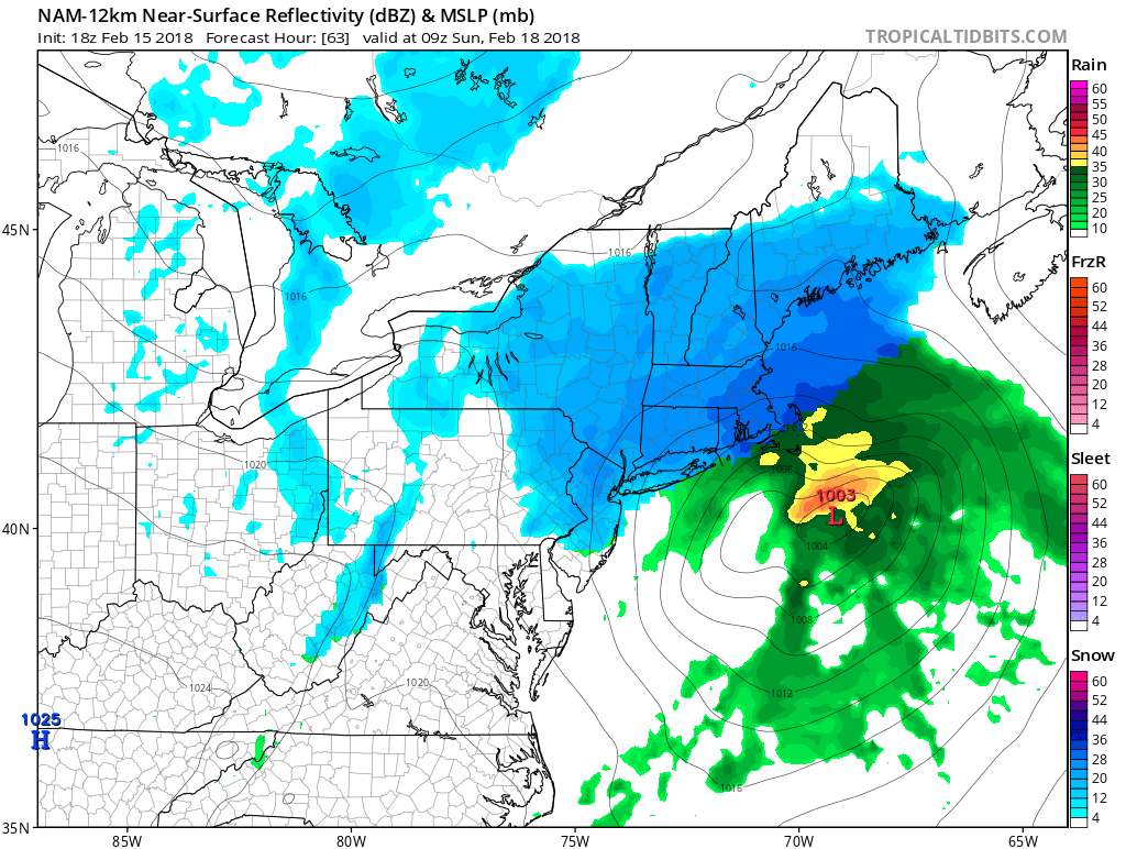
Then the storm is done by 7am for PA and much of the Mid-Atlantic. Coastal New England could still be experiencing snow. Nam model for 7am Sunday:

Model images courtesy of www.tropicaltidbits.com
Please share with your friends using the buttons below! Thanks!
-Mike G.
East Coast Weather Authority
You must be logged in to post a comment.