
As we can imagine, with the time change comes longer days, and with longer days comes warmer days, at least somewhat. And as March is a month that can have wild temperature swings, one is possible later this week. It will be warmer than average for most of this week, but then on Thursday, a powerful cold front will move in from our west. Ahead of this front will be the potential for discreet supercells, which are rotating thunderstorms. This is the same system that caused tornadoes in Texas and may cause an outbreak in Mississippi and Alabama this week.
The only saving grace could be if we get a Carolina Wedge to form, which is what we call cold-air damming. If temperatures do not get out of the 40s or 50s on Thursday, then severe chances will be greatly reduced.
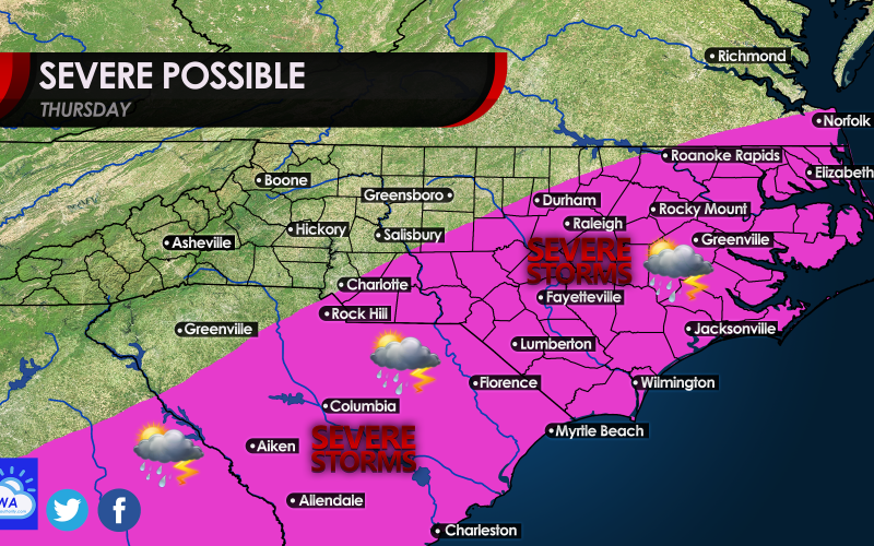
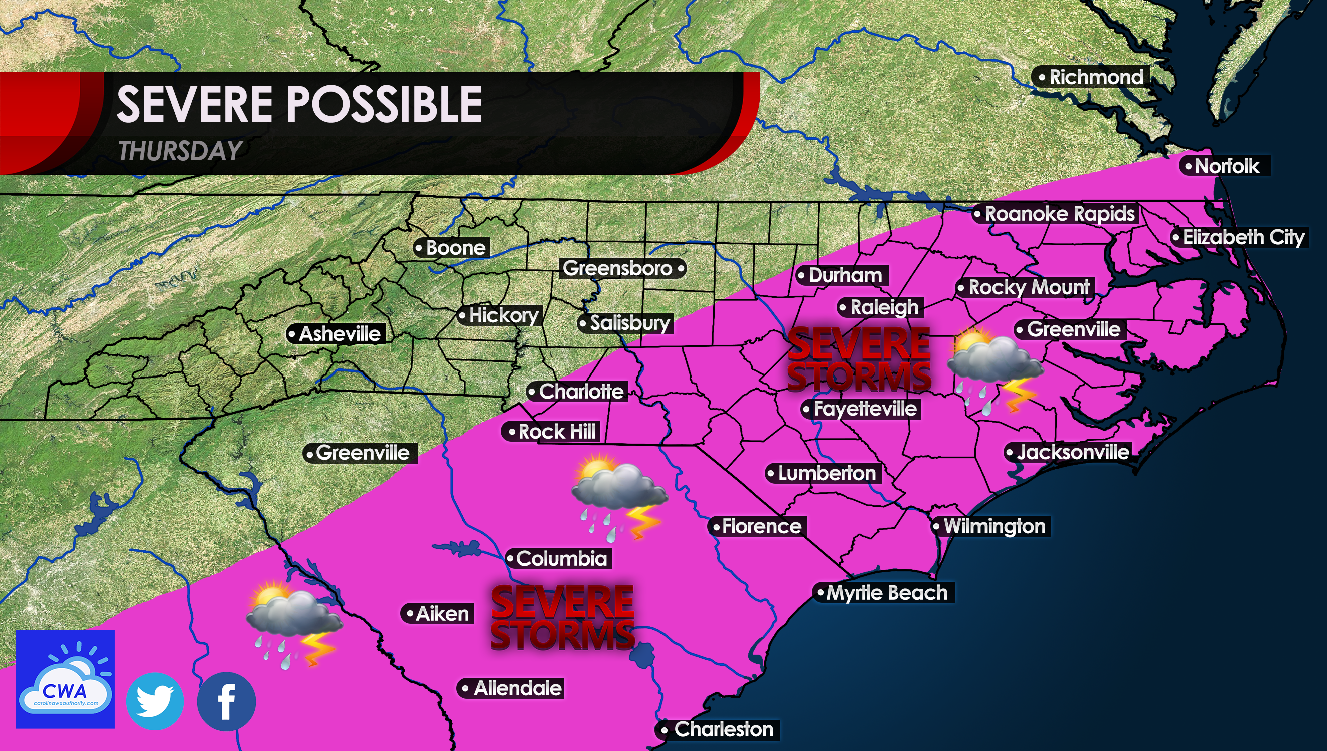
However, if not, then we need to watch this system carefully as it moves our way this week. The chances for tornadoes and straight-line wind damage exits, as anyone in the pink/purple below, will be at the highest risk for seeing such.
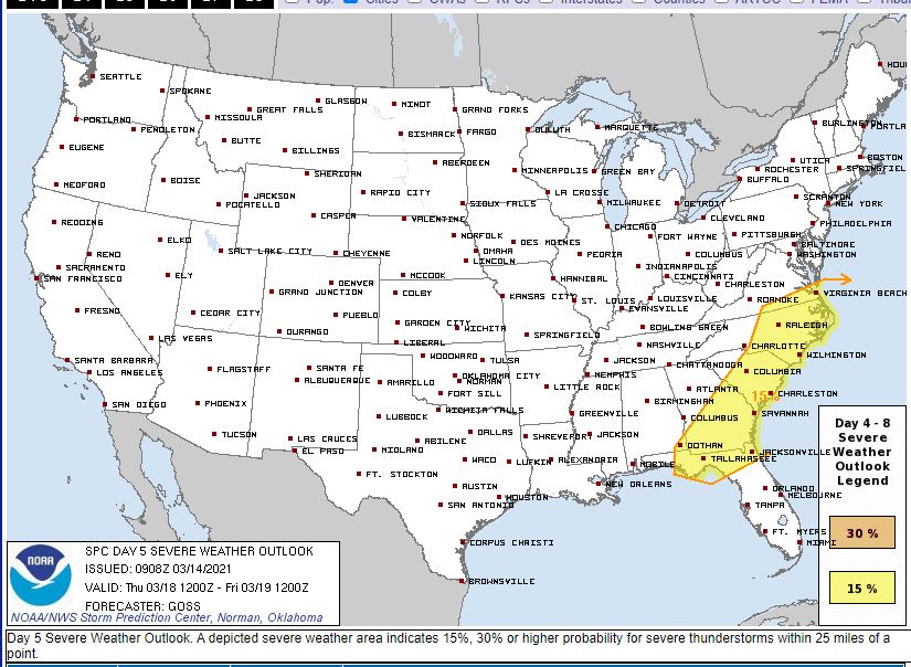
The Storm Prediction Center has already issued a Day 5 outlook for our region. Currently, we are at a 15% chances of seeing severe weather within 25 miles of a given point:
At this point, there is no reason to panic, as things can still change this far out. The only thing to think about would be to have a plan of safety in case a severe storm or tornado heads for your neighborhood. Consult your local NWS for all safety tips and tricks. And most of all, keep watching your local news and media outlets, and NWS, for all the latest updates!
You must be logged in to post a comment.